Botuș geodata
Botuș (Suceava) is a populated place; located in Romania in Europe/Bucharest (GMT+3) time zone. With population of 734 people, there are 5375 cities with bigger population in this country. Compared to other cities in Romania, 92.2% of cities are located further ↓South; 51.9% of cities are located further ←West and 98.8% of cities have lower elevation than Botuș. Note1


Botuș GPS coordinates[2]
47° 33' 35.568" North, 25° 20' 30.264" East
| Map corner | latitude | longitude |
|---|---|---|
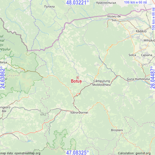
| Upper-left | 48.03221°, | 24.63862° |
| Center: | 47.55988°, | 25.34174° |
| Lower-right: | 47.08325°, | 26.04487° |
| Map W x H: | 105.5×105.5 km | = 65.6×65.6mi |
| max Lat: | 48.23793° ⇑7.8% North |
| Botuș: | 47.55988° |
| min Lat: | ⇓92.2% South 43.65638° |
| min Long | Botuș | max Long |
| 20.31667° | 25.34174° | 29.65403° |
| W 51.9%⇐ | ⇒48.1% E |
Elevation
Elevation of Botuș is 843 m = 2766 ft, and this is 588.1 m = 1929 ft above average elevation for this country.
| Max E: |
1278 m = 4193 ft | 1.2% |
| Botuș | 843 m 2766 ft | |
| Avg. | 254.9 m = 836 ft | |
Min E: |
-2 m = -7 ft | 98.8% |
See also: Romania elevation on elevation.city.
Geographical zone
Botuș is located in North temperate zone (between Tropic of Cancer and the Arctic Circle). Distance of this North polar circle is 2113 km =1313 mi to North.| Distance of | km | miles | from Botuș |
|---|---|---|---|
| North Pole | 4718.9 | 2932.2 | to North |
| Arctic Circle | 2113 | 1313 | to North |
| Tropic Cancer | 2682.2 | 1666.6 | to South |
| Equator | 5288.2 | 3285.9 | to South |


Nearby cities:
15 places around Botuș: (largest is in red/bold)
• Argestru
19.9 km =12.4 mi,  183°
183°
• Benia
12.9 km =8 mi,  334°
334°
• Breaza
6.4 km =4 mi,  343°
343°
• Ciocănești
9.9 km =6.2 mi,  208°
208°
• Colacu
3.3 km =2.1 mi,  136°
136°
• Câmpulung Moldovenesc
17.1 km =10.6 mi,  99°
99°
• Cârlibaba
15.9 km =9.9 mi,  279°
279°
• Demacușa
19.6 km =12.2 mi,  38°
38°
• Fundu Moldovei
5.3 km =3.3 mi,  124°
124°
• Iacobeni
14.2 km =8.8 mi,  187°
187°
• Moldova Suliţa
15.4 km =9.6 mi, 333°
• Moldoviţa
19.9 km =12.4 mi,  46°
46°
• Pojorâta
9.4 km =5.8 mi, 120°
• Sadova
12.2 km =7.6 mi, 103°
• Vatra Moldoviţei
19.6 km =12.2 mi,  59°
59°
Sources, notices
• [Note1] Compared only with cities in Romania existing in our database
• [Src1] Map data: © OpenStreetMap contributors (CC-BY-SA)
• [Src2] Other city data from geonames.org with taken over terms of usage.
• [Src3] Geographical zone / Annual Mean Temperature by Robert A. Rohde @ Wikipedia
