Roșcani geodata
Roșcani (Iaşi) is a seat of a second-order administrative division; located in Romania in Europe/Bucharest (GMT+3) time zone. With population of 683 people, there are 5675 cities with bigger population in this country. Compared to other cities in Romania, 90% of cities are located further ↓South; 89.6% of cities are located further ←West and 79.2% of cities have higher elevation than Roșcani. Note1


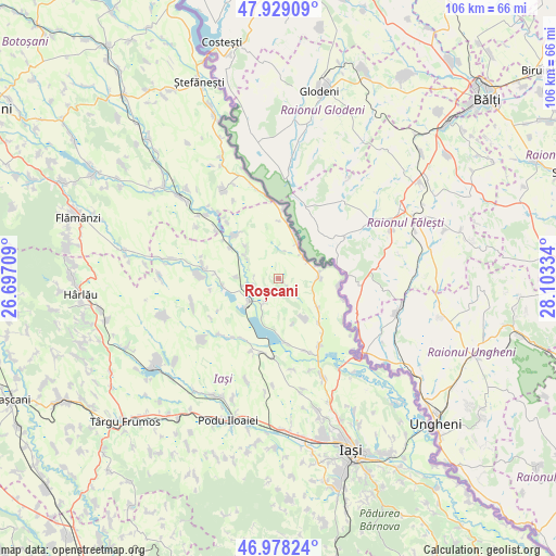
Roșcani GPS coordinates[2]
47° 27' 20.916" North, 27° 24' 0.756" East
| Map corner | latitude | longitude |
|---|---|---|
| Upper-left | 47.92909°, | 26.69709° |
| Center: | 47.45581°, | 27.40021° |
| Lower-right: | 46.97824°, | 28.10334° |
| Map W x H: | 105.7×105.7 km | = 65.7×65.7mi |
| max Lat: | 48.23793° ⇑10% North |
| Roșcani: | 47.45581° |
| min Lat: | ⇓90% South 43.65638° |
| min Long | Roșcani | max Long |
| 20.31667° | 27.40021° | 29.65403° |
| W 89.6%⇐ | ⇒10.4% E |
Elevation
Elevation of Roșcani is 97 m = 318 ft, and this is 157.9 m = 518 ft below average elevation for this country.
| Max E: |
1278 m = 4193 ft | 79.2% |
| Avg. | 254.9 m = 836 ft | |
| Roșcani | 97 m = 318 ft | |
Min E: |
-2 m = -7 ft | 20.8% |
See also: Romania elevation on elevation.city.
Geographical zone
Roșcani is located in North temperate zone (between Tropic of Cancer and the Arctic Circle). Distance of this North polar circle is 2124.6 km =1320.2 mi to North.| Distance of | km | miles | from Roșcani |
|---|---|---|---|
| North Pole | 4730.5 | 2939.4 | to North |
| Arctic Circle | 2124.6 | 1320.2 | to North |
| Tropic Cancer | 2670.7 | 1659.5 | to South |
| Equator | 5276.6 | 3278.7 | to South |


Nearby cities:
15 places around Roșcani: (largest is in red/bold)
• Alexandru cel Bun
7.9 km =4.9 mi,  271°
271°
• Andrieşeni
12.3 km =7.6 mi,  314°
314°
• Bivolari
9 km =5.6 mi,  16°
16°
• Borșa
5.2 km =3.2 mi,  211°
211°
• Bălteni
9.5 km =5.9 mi,  126°
126°
• Hermeziu
11.6 km =7.2 mi,  96°
96°
• Hălceni
10.4 km =6.5 mi,  261°
261°
• Mihail Kogălniceanu
12.2 km =7.6 mi,  174°
174°
• Perieni
9.7 km =6 mi,  144°
144°
• Probota
11 km =6.8 mi, 137°
• Rădeni
4 km =2.5 mi, 138°
• Spineni
7.1 km =4.4 mi,  301°
301°
• Trifeşti
8.8 km =5.5 mi,  94°
94°
• Vlădeni
6.7 km =4.2 mi,  229°
229°
• Zaboloteni
7.7 km =4.8 mi,  73°
73°
Sources, notices
• [Note1] Compared only with cities in Romania existing in our database
• [Src1] Map data: © OpenStreetMap contributors (CC-BY-SA)
• [Src2] Other city data from geonames.org with taken over terms of usage.
• [Src3] Geographical zone / Annual Mean Temperature by Robert A. Rohde @ Wikipedia
