Rădeni geodata
Rădeni (Iaşi) is a populated place; located in Romania in Europe/Bucharest (GMT+3) time zone. With population of 715 people, there are 5484 cities with bigger population in this country. Compared to other cities in Romania, 89.4% of cities are located further ↓South; 90.1% of cities are located further ←West and 86.8% of cities have higher elevation than Rădeni. Note1


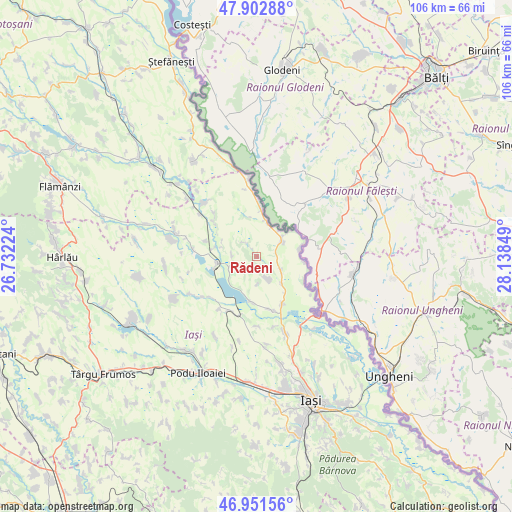
Rădeni GPS coordinates[2]
47° 25' 45.732" North, 27° 26' 7.296" East
| Map corner | latitude | longitude |
|---|---|---|
| Upper-left | 47.90288°, | 26.73224° |
| Center: | 47.42937°, | 27.43536° |
| Lower-right: | 46.95156°, | 28.13849° |
| Map W x H: | 105.8×105.8 km | = 65.7×65.7mi |
| max Lat: | 48.23793° ⇑10.6% North |
| Rădeni: | 47.42937° |
| min Lat: | ⇓89.4% South 43.65638° |
| min Long | Rădeni | max Long |
| 20.31667° | 27.43536° | 29.65403° |
| W 90.1%⇐ | ⇒9.9% E |
Elevation
Elevation of Rădeni is 72 m = 236 ft, and this is 182.9 m = 600 ft below average elevation for this country.
| Max E: |
1278 m = 4193 ft | 86.8% |
| Avg. | 254.9 m = 836 ft | |
| Rădeni | 72 m = 236 ft | |
Min E: |
-2 m = -7 ft | 13.2% |
See also: Romania elevation on elevation.city.
Geographical zone
Rădeni is located in North temperate zone (between Tropic of Cancer and the Arctic Circle). Distance of this North polar circle is 2127.5 km =1322 mi to North.| Distance of | km | miles | from Rădeni |
|---|---|---|---|
| North Pole | 4733.4 | 2941.2 | to North |
| Arctic Circle | 2127.5 | 1322 | to North |
| Tropic Cancer | 2667.7 | 1657.6 | to South |
| Equator | 5273.7 | 3276.9 | to South |


Nearby cities:
15 places around Rădeni: (largest is in red/bold)
• Alexandru cel Bun
11 km =6.8 mi,  286°
286°
• Bivolari
11.6 km =7.2 mi,  359°
359°
• Borșa
5.5 km =3.4 mi,  254°
254°
• Bălteni
5.7 km =3.5 mi,  119°
119°
• Cârniceni
11.3 km =7 mi,  152°
152°
• Hermeziu
9 km =5.6 mi,  79°
79°
• Mihail Kogălniceanu
9.3 km =5.8 mi,  189°
189°
• Perieni
5.8 km =3.6 mi, 149°
• Probota
7.1 km =4.4 mi,  136°
136°
• Roșcani
4 km =2.5 mi,  318°
318°
• Spineni
11 km =6.8 mi,  307°
307°
• Trifeşti
6.5 km =4 mi,  69°
69°
• Vlădeni
7.8 km =4.8 mi,  259°
259°
• Zaboloteni
7 km =4.3 mi,  42°
42°
• Ţigănaşi
10.9 km =6.8 mi,  167°
167°
Sources, notices
• [Note1] Compared only with cities in Romania existing in our database
• [Src1] Map data: © OpenStreetMap contributors (CC-BY-SA)
• [Src2] Other city data from geonames.org with taken over terms of usage.
• [Src3] Geographical zone / Annual Mean Temperature by Robert A. Rohde @ Wikipedia
