Prigor geodata
Prigor (Caraş-Severin) is a seat of a second-order administrative division; located in Romania in Europe/Bucharest (GMT+3) time zone. With population of 2,880 people, there are 1855 cities with bigger population in this country. Compared to other cities in Romania, 71.9% of cities are located further ↑North; 93.5% of cities are located further →East and 78.1% of cities have lower elevation than Prigor. Note1


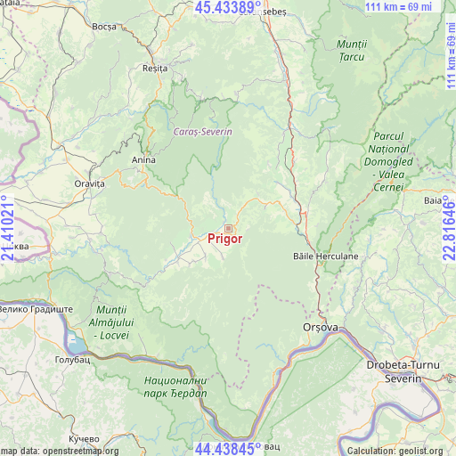
Prigor GPS coordinates[2]
44° 56' 17.988" North, 22° 6' 47.988" East
| Map corner | latitude | longitude |
|---|---|---|
| Upper-left | 45.43389°, | 21.41021° |
| Center: | 44.93833°, | 22.11333° |
| Lower-right: | 44.43845°, | 22.81646° |
| Map W x H: | 110.7×110.7 km | = 68.8×68.8mi |
| max Lat: | 48.23793° ⇑71.9% North |
| Prigor: | 44.93833° |
| min Lat: | ⇓28.1% South 43.65638° |
| min Long | Prigor | max Long |
| 20.31667° | 22.11333° | 29.65403° |
| W 6.5%⇐ | ⇒93.5% E |
Elevation
Elevation of Prigor is 377 m = 1237 ft, and this is 122.1 m = 401 ft above average elevation for this country.
| Max E: |
1278 m = 4193 ft | 21.9% |
| Prigor | 377 m 1237 ft | |
| Avg. | 254.9 m = 836 ft | |
Min E: |
-2 m = -7 ft | 78.1% |
See also: Romania elevation on elevation.city.
Geographical zone
Prigor is located in North temperate zone (between Tropic of Cancer and the Arctic Circle). Distance of this Northern Tropic circle is 2390.8 km =1485.6 mi to South.| Distance of | km | miles | from Prigor |
|---|---|---|---|
| North Pole | 5010.4 | 3113.3 | to North |
| Arctic Circle | 2404.5 | 1494.1 | to North |
| Tropic Cancer | 2390.8 | 1485.6 | to South |
| Equator | 4996.7 | 3104.8 | to South |


Nearby cities:
15 places around Prigor: (largest is in red/bold)
• Borlovenii Noi
4.1 km =2.5 mi,  34°
34°
• Borlovenii Vechi
1.9 km =1.2 mi,  350°
350°
• Bozovici
8.8 km =5.5 mi,  270°
270°
• Bănia
7.2 km =4.5 mi,  228°
228°
• Dalboșeț
14.7 km =9.1 mi,  235°
235°
• Eftimie Murgu
4.5 km =2.8 mi,  200°
200°
• Globu Craiovei
13.9 km =8.6 mi,  62°
62°
• Gârbovăț
11.3 km =7 mi, 226°
• Lăpuşnicel
10.2 km =6.3 mi, 60°
• Lăpuşnicu Mare
13.6 km =8.5 mi,  258°
258°
• Petnic
14.6 km =9.1 mi,  72°
72°
• Prilipeț
4 km =2.5 mi, 257°
• Pârvova
11.2 km =7 mi,  40°
40°
• Pătaș
1.7 km =1.1 mi,  326°
326°
• Șopotu Vechi
12.9 km =8 mi, 226°
Sources, notices
• [Note1] Compared only with cities in Romania existing in our database
• [Src1] Map data: © OpenStreetMap contributors (CC-BY-SA)
• [Src2] Other city data from geonames.org with taken over terms of usage.
• [Src3] Geographical zone / Annual Mean Temperature by Robert A. Rohde @ Wikipedia
