Bănia geodata
Bănia (Caraş-Severin) is a seat of a second-order administrative division; located in Romania in Europe/Bucharest (GMT+3) time zone. With population of 1,939 people, there are 2662 cities with bigger population in this country. Compared to other cities in Romania, 73.3% of cities are located further ↑North; 94.1% of cities are located further →East and 64.4% of cities have lower elevation than Bănia. Note1


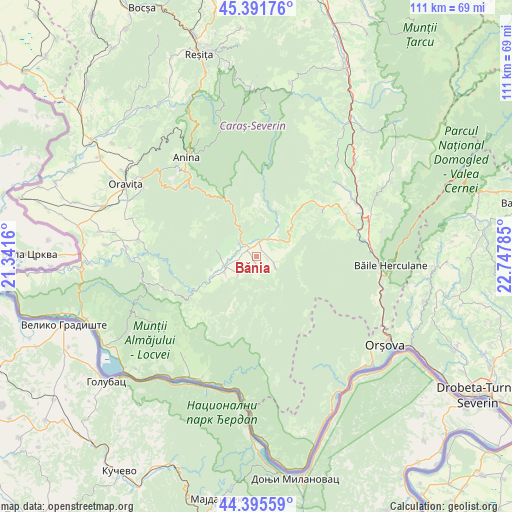
Bănia GPS coordinates[2]
44° 53' 44.988" North, 22° 2' 40.992" East
| Map corner | latitude | longitude |
|---|---|---|
| Upper-left | 45.39176°, | 21.3416° |
| Center: | 44.89583°, | 22.04472° |
| Lower-right: | 44.39559°, | 22.74785° |
| Map W x H: | 110.8×110.8 km | = 68.8×68.8mi |
| max Lat: | 48.23793° ⇑73.3% North |
| Bănia: | 44.89583° |
| min Lat: | ⇓26.7% South 43.65638° |
| min Long | Bănia | max Long |
| 20.31667° | 22.04472° | 29.65403° |
| W 5.9%⇐ | ⇒94.1% E |
Elevation
Elevation of Bănia is 286 m = 938 ft, and this is 31.1 m = 102 ft above average elevation for this country.
| Max E: |
1278 m = 4193 ft | 35.6% |
| Bănia | 286 m 938 ft | |
| Avg. | 254.9 m = 836 ft | |
Min E: |
-2 m = -7 ft | 64.4% |
See also: Romania elevation on elevation.city.
Geographical zone
Bănia is located in North temperate zone (between Tropic of Cancer and the Arctic Circle). Distance of this Northern Tropic circle is 2386 km =1482.6 mi to South.| Distance of | km | miles | from Bănia |
|---|---|---|---|
| North Pole | 5015.1 | 3116.2 | to North |
| Arctic Circle | 2409.2 | 1497 | to North |
| Tropic Cancer | 2386 | 1482.6 | to South |
| Equator | 4991.9 | 3101.8 | to South |


Nearby cities:
15 places around Bănia: (largest is in red/bold)
• Borlovenii Noi
11.2 km =7 mi,  43°
43°
• Borlovenii Vechi
8.3 km =5.2 mi, 37°
• Bozovici
5.9 km =3.7 mi,  324°
324°
• Dalboșeț
7.7 km =4.8 mi,  242°
242°
• Eftimie Murgu
3.8 km =2.4 mi,  82°
82°
• Gârbovăț
4.2 km =2.6 mi,  221°
221°
• Lăpuşnicel
17.3 km =10.7 mi,  55°
55°
• Lăpuşnicu Mare
8.1 km =5 mi,  283°
283°
• Moceriș
10 km =6.2 mi,  253°
253°
• Prigor
7.2 km =4.5 mi,  48°
48°
• Prilipeț
4.1 km =2.5 mi,  20°
20°
• Pârvova
18.4 km =11.4 mi, 43°
• Pătaș
7.6 km =4.7 mi, 35°
• Şopotu Nou
15.5 km =9.6 mi, 247°
• Șopotu Vechi
5.7 km =3.5 mi, 222°
Sources, notices
• [Note1] Compared only with cities in Romania existing in our database
• [Src1] Map data: © OpenStreetMap contributors (CC-BY-SA)
• [Src2] Other city data from geonames.org with taken over terms of usage.
• [Src3] Geographical zone / Annual Mean Temperature by Robert A. Rohde @ Wikipedia
