Eftimie Murgu geodata
Eftimie Murgu (Caraş-Severin) is a seat of a second-order administrative division; located in Romania in Europe/Bucharest (GMT+3) time zone. With population of 1,761 people, there are 2859 cities with bigger population in this country. Compared to other cities in Romania, 73% of cities are located further ↑North; 93.7% of cities are located further →East and 79.6% of cities have lower elevation than Eftimie Murgu. Note1


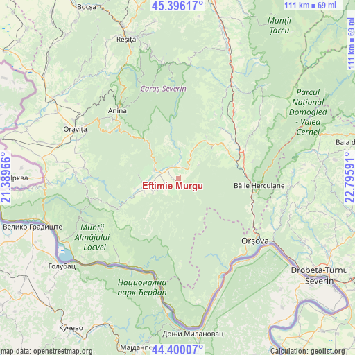
Eftimie Murgu GPS coordinates[2]
44° 54' 1.008" North, 22° 5' 34.008" East
| Map corner | latitude | longitude |
|---|---|---|
| Upper-left | 45.39617°, | 21.38966° |
| Center: | 44.90028°, | 22.09278° |
| Lower-right: | 44.40007°, | 22.79591° |
| Map W x H: | 110.8×110.8 km | = 68.8×68.8mi |
| max Lat: | 48.23793° ⇑73% North |
| Eftimie Murgu: | 44.90028° |
| min Lat: | ⇓27% South 43.65638° |
| min Long | Eftimie Murgu | max Long |
| 20.31667° | 22.09278° | 29.65403° |
| W 6.3%⇐ | ⇒93.7% E |
Elevation
Elevation of Eftimie Murgu is 389 m = 1276 ft, and this is 134.1 m = 440 ft above average elevation for this country.
| Max E: |
1278 m = 4193 ft | 20.4% |
| Eftimie Murgu | 389 m 1276 ft | |
| Avg. | 254.9 m = 836 ft | |
Min E: |
-2 m = -7 ft | 79.6% |
See also: Romania elevation on elevation.city.
Geographical zone
Eftimie Murgu is located in North temperate zone (between Tropic of Cancer and the Arctic Circle). Distance of this Northern Tropic circle is 2386.5 km =1482.9 mi to South.| Distance of | km | miles | from Eftimie Murgu |
|---|---|---|---|
| North Pole | 5014.6 | 3115.9 | to North |
| Arctic Circle | 2408.7 | 1496.7 | to North |
| Tropic Cancer | 2386.5 | 1482.9 | to South |
| Equator | 4992.4 | 3102.1 | to South |


Nearby cities:
15 places around Eftimie Murgu: (largest is in red/bold)
• Borlovenii Noi
8.6 km =5.3 mi,  27°
27°
• Borlovenii Vechi
6.2 km =3.9 mi,  12°
12°
• Bozovici
8.4 km =5.2 mi,  300°
300°
• Bănia
3.8 km =2.4 mi,  262°
262°
• Dalboșeț
11.3 km =7 mi,  249°
249°
• Globu Craiovei
17.6 km =10.9 mi,  53°
53°
• Gârbovăț
7.5 km =4.7 mi,  241°
241°
• Lăpuşnicel
14 km =8.7 mi, 48°
• Lăpuşnicu Mare
11.8 km =7.3 mi,  276°
276°
• Moceriș
13.8 km =8.6 mi, 256°
• Prigor
4.5 km =2.8 mi,  20°
20°
• Prilipeț
4.1 km =2.5 mi,  325°
325°
• Pârvova
15.6 km =9.7 mi, 34°
• Pătaș
5.7 km =3.5 mi, 6°
• Șopotu Vechi
9 km =5.6 mi, 238°
Sources, notices
• [Note1] Compared only with cities in Romania existing in our database
• [Src1] Map data: © OpenStreetMap contributors (CC-BY-SA)
• [Src2] Other city data from geonames.org with taken over terms of usage.
• [Src3] Geographical zone / Annual Mean Temperature by Robert A. Rohde @ Wikipedia
