Pătaș geodata
Pătaș (Caraş-Severin) is a populated place; located in Romania in Europe/Bucharest (GMT+3) time zone. With population of 755 people, there are 5260 cities with bigger population in this country. Compared to other cities in Romania, 71.3% of cities are located further ↑North; 93.6% of cities are located further →East and 64.5% of cities have lower elevation than Pătaș. Note1


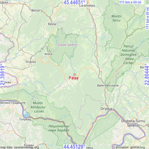
Pătaș GPS coordinates[2]
44° 57' 3.816" North, 22° 6' 4.716" East
| Map corner | latitude | longitude |
|---|---|---|
| Upper-left | 45.44651°, | 21.39819° |
| Center: | 44.95106°, | 22.10131° |
| Lower-right: | 44.45129°, | 22.80444° |
| Map W x H: | 110.7×110.7 km | = 68.8×68.8mi |
| max Lat: | 48.23793° ⇑71.3% North |
| Pătaș: | 44.95106° |
| min Lat: | ⇓28.7% South 43.65638° |
| min Long | Pătaș | max Long |
| 20.31667° | 22.10131° | 29.65403° |
| W 6.4%⇐ | ⇒93.6% E |
Elevation
Elevation of Pătaș is 287 m = 942 ft, and this is 32.1 m = 105 ft above average elevation for this country.
| Max E: |
1278 m = 4193 ft | 35.5% |
| Pătaș | 287 m 942 ft | |
| Avg. | 254.9 m = 836 ft | |
Min E: |
-2 m = -7 ft | 64.5% |
See also: Romania elevation on elevation.city.
Geographical zone
Pătaș is located in North temperate zone (between Tropic of Cancer and the Arctic Circle). Distance of this Northern Tropic circle is 2392.2 km =1486.4 mi to South.| Distance of | km | miles | from Pătaș |
|---|---|---|---|
| North Pole | 5009 | 3112.4 | to North |
| Arctic Circle | 2403.1 | 1493.2 | to North |
| Tropic Cancer | 2392.2 | 1486.4 | to South |
| Equator | 4998.1 | 3105.7 | to South |


Nearby cities:
15 places around Pătaș: (largest is in red/bold)
• Borlovenii Noi
3.9 km =2.4 mi,  59°
59°
• Borlovenii Vechi
0.8 km =0.5 mi,  54°
54°
• Bozovici
8 km =5 mi,  260°
260°
• Bănia
7.6 km =4.7 mi,  215°
215°
• Dalboșeț
14.8 km =9.2 mi,  229°
229°
• Eftimie Murgu
5.7 km =3.5 mi,  186°
186°
• Globu Craiovei
14.2 km =8.8 mi,  69°
69°
• Gârbovăț
11.7 km =7.3 mi, 217°
• Lăpuşnicel
10.5 km =6.5 mi, 70°
• Lăpuşnicu Mare
13.1 km =8.1 mi,  251°
251°
• Petnic
15.2 km =9.4 mi,  78°
78°
• Prigor
1.7 km =1.1 mi,  146°
146°
• Prilipeț
3.8 km =2.4 mi, 232°
• Pârvova
10.9 km =6.8 mi, 49°
• Șopotu Vechi
13.3 km =8.3 mi, 218°
Sources, notices
• [Note1] Compared only with cities in Romania existing in our database
• [Src1] Map data: © OpenStreetMap contributors (CC-BY-SA)
• [Src2] Other city data from geonames.org with taken over terms of usage.
• [Src3] Geographical zone / Annual Mean Temperature by Robert A. Rohde @ Wikipedia
