Postârnacu geodata
Postârnacu (Dâmboviţa) is a populated place; located in Romania in Europe/Bucharest (GMT+3) time zone. With population of 936 people, there are 4499 cities with bigger population in this country. Compared to other cities in Romania, 76.2% of cities are located further ↑North; 60.8% of cities are located further ←West and 64.2% of cities have higher elevation than Postârnacu. Note1


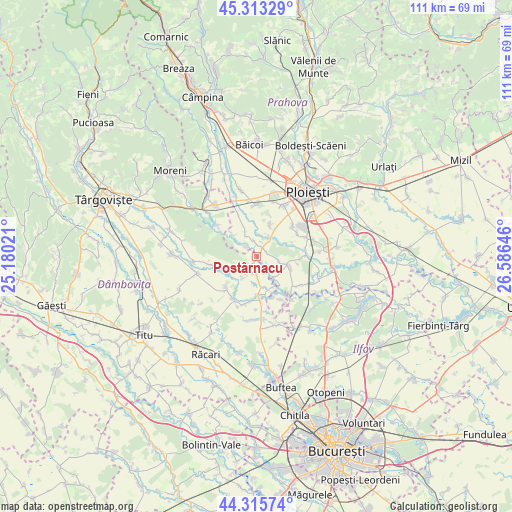
Postârnacu GPS coordinates[2]
44° 49' 0.012" North, 25° 52' 59.988" East
| Map corner | latitude | longitude |
|---|---|---|
| Upper-left | 45.31329°, | 25.18021° |
| Center: | 44.81667°, | 25.88333° |
| Lower-right: | 44.31574°, | 26.58646° |
| Map W x H: | 110.9×110.9 km | = 68.9×68.9mi |
| max Lat: | 48.23793° ⇑76.2% North |
| Postârnacu: | 44.81667° |
| min Lat: | ⇓23.8% South 43.65638° |
| min Long | Postârnacu | max Long |
| 20.31667° | 25.88333° | 29.65403° |
| W 60.8%⇐ | ⇒39.2% E |
Elevation
Elevation of Postârnacu is 150 m = 492 ft, and this is 104.9 m = 344 ft below average elevation for this country.
| Max E: |
1278 m = 4193 ft | 64.2% |
| Avg. | 254.9 m = 836 ft | |
| Postârnacu | 150 m = 492 ft | |
Min E: |
-2 m = -7 ft | 35.8% |
See also: Romania elevation on elevation.city.
Geographical zone
Postârnacu is located in North temperate zone (between Tropic of Cancer and the Arctic Circle). Distance of this Northern Tropic circle is 2377.2 km =1477.1 mi to South.| Distance of | km | miles | from Postârnacu |
|---|---|---|---|
| North Pole | 5023.9 | 3121.7 | to North |
| Arctic Circle | 2418 | 1502.5 | to North |
| Tropic Cancer | 2377.2 | 1477.1 | to South |
| Equator | 4983.1 | 3096.4 | to South |


Nearby cities:
15 places around Postârnacu: (largest is in red/bold)
• Bechinești
6 km =3.7 mi,  241°
241°
• Brătești
3 km =1.9 mi,  123°
123°
• Băltița
3.4 km =2.1 mi,  313°
313°
• Cocorăștii Colț
2.3 km =1.4 mi,  32°
32°
• Cocorăștii Grind
3.4 km =2.1 mi,  351°
351°
• Corneşti
3.9 km =2.4 mi,  199°
199°
• Frasinu
3.3 km =2.1 mi,  209°
209°
• Hăbud
5.9 km =3.7 mi,  138°
138°
• Ibrianu
5.6 km =3.5 mi, 214°
• Măneşti
6.1 km =3.8 mi,  334°
334°
• Stăncești
5 km =3.1 mi, 30°
• Târgşoru Vechi
6.1 km =3.8 mi, 25°
• Ungureni
3.8 km =2.4 mi,  159°
159°
• Varnița
5 km =3.1 mi,  102°
102°
• Şirna
5.6 km =3.5 mi,  109°
109°
Sources, notices
• [Note1] Compared only with cities in Romania existing in our database
• [Src1] Map data: © OpenStreetMap contributors (CC-BY-SA)
• [Src2] Other city data from geonames.org with taken over terms of usage.
• [Src3] Geographical zone / Annual Mean Temperature by Robert A. Rohde @ Wikipedia
