Băltița geodata
Băltița (Prahova) is a populated place; located in Romania in Europe/Bucharest (GMT+3) time zone. With population of 825 people, there are 4936 cities with bigger population in this country. Compared to other cities in Romania, 75.3% of cities are located further ↑North; 60.3% of cities are located further ←West and 60.6% of cities have higher elevation than Băltița. Note1


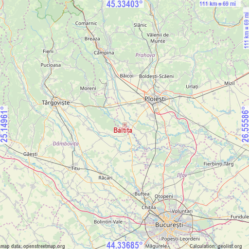
Băltița GPS coordinates[2]
44° 50' 15.36" North, 25° 51' 9.828" East
| Map corner | latitude | longitude |
|---|---|---|
| Upper-left | 45.33403°, | 25.14961° |
| Center: | 44.8376°, | 25.85273° |
| Lower-right: | 44.33685°, | 26.55586° |
| Map W x H: | 110.9×110.9 km | = 68.9×68.9mi |
| max Lat: | 48.23793° ⇑75.3% North |
| Băltița: | 44.8376° |
| min Lat: | ⇓24.7% South 43.65638° |
| min Long | Băltița | max Long |
| 20.31667° | 25.85273° | 29.65403° |
| W 60.3%⇐ | ⇒39.7% E |
Elevation
Elevation of Băltița is 164 m = 538 ft, and this is 90.9 m = 298 ft below average elevation for this country.
| Max E: |
1278 m = 4193 ft | 60.6% |
| Avg. | 254.9 m = 836 ft | |
| Băltița | 164 m = 538 ft | |
Min E: |
-2 m = -7 ft | 39.4% |
See also: Romania elevation on elevation.city.
Geographical zone
Băltița is located in North temperate zone (between Tropic of Cancer and the Arctic Circle). Distance of this Northern Tropic circle is 2379.6 km =1478.6 mi to South.| Distance of | km | miles | from Băltița |
|---|---|---|---|
| North Pole | 5021.6 | 3120.3 | to North |
| Arctic Circle | 2415.7 | 1501 | to North |
| Tropic Cancer | 2379.6 | 1478.6 | to South |
| Equator | 4985.5 | 3097.8 | to South |


Nearby cities:
15 places around Băltița: (largest is in red/bold)
• Bechinești
5.9 km =3.7 mi,  208°
208°
• Brătești
6.4 km =4 mi,  129°
129°
• Coada Izvorului
3.5 km =2.2 mi,  309°
309°
• Cocorăștii Colț
3.7 km =2.3 mi,  95°
95°
• Cocorăștii Grind
2.2 km =1.4 mi,  60°
60°
• Corneşti
6.1 km =3.8 mi,  169°
169°
• Finta Mare
5.9 km =3.7 mi,  224°
224°
• Frasinu
5.2 km =3.2 mi, 171°
• Ibrianu
7 km =4.3 mi,  185°
185°
• Măneşti
3.2 km =2 mi,  356°
356°
• Postârnacu
3.4 km =2.1 mi, 133°
• Stăncești
5.3 km =3.3 mi,  68°
68°
• Târgşoru Vechi
6 km =3.7 mi, 57°
• Ungureni
7 km =4.3 mi,  147°
147°
• Zalhanaua
7.4 km =4.6 mi,  346°
346°
Sources, notices
• [Note1] Compared only with cities in Romania existing in our database
• [Src1] Map data: © OpenStreetMap contributors (CC-BY-SA)
• [Src2] Other city data from geonames.org with taken over terms of usage.
• [Src3] Geographical zone / Annual Mean Temperature by Robert A. Rohde @ Wikipedia
