Jidoștița geodata
Jidoștița (Mehedinţi) is a populated place; located in Romania in Europe/Bucharest (GMT+3) time zone. With population of 1,043 people, there are 4148 cities with bigger population in this country. Compared to other cities in Romania, 79.7% of cities are located further ↑North; 89% of cities are located further →East and 54.6% of cities have lower elevation than Jidoștița. Note1


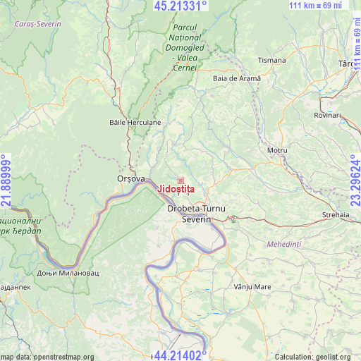
Jidoștița GPS coordinates[2]
44° 42' 56.952" North, 22° 35' 35.196" East
| Map corner | latitude | longitude |
|---|---|---|
| Upper-left | 45.21331°, | 21.88999° |
| Center: | 44.71582°, | 22.59311° |
| Lower-right: | 44.21402°, | 23.29624° |
| Map W x H: | 111.1×111.1 km | = 69×69mi |
| max Lat: | 48.23793° ⇑79.7% North |
| Jidoștița: | 44.71582° |
| min Lat: | ⇓20.3% South 43.65638° |
| min Long | Jidoștița | max Long |
| 20.31667° | 22.59311° | 29.65403° |
| W 11%⇐ | ⇒89% E |
Elevation
Elevation of Jidoștița is 236 m = 774 ft, and this is 18.9 m = 62 ft below average elevation for this country.
| Max E: |
1278 m = 4193 ft | 45.4% |
| Avg. | 254.9 m = 836 ft | |
| Jidoștița | 236 m = 774 ft | |
Min E: |
-2 m = -7 ft | 54.6% |
See also: Romania elevation on elevation.city.
Geographical zone
Jidoștița is located in North temperate zone (between Tropic of Cancer and the Arctic Circle). Distance of this Northern Tropic circle is 2366 km =1470.2 mi to South.| Distance of | km | miles | from Jidoștița |
|---|---|---|---|
| North Pole | 5035.1 | 3128.7 | to North |
| Arctic Circle | 2429.2 | 1509.4 | to North |
| Tropic Cancer | 2366 | 1470.2 | to South |
| Equator | 4971.9 | 3089.4 | to South |


Nearby cities:
15 places around Jidoștița: (largest is in red/bold)
• Bobaița
11.2 km =7 mi,  64°
64°
• Brezniţa Ocol
5.8 km =3.6 mi,  159°
159°
• Bâlvăneşti
11.4 km =7.1 mi,  37°
37°
• Drobeta-Turnu Severin
11 km =6.8 mi,  154°
154°
• Dudașu
10.8 km =6.7 mi,  130°
130°
• Dudașu Schelei
8.3 km =5.2 mi,  177°
177°
• Godeanu
9.6 km =6 mi,  7°
7°
• Gura Văii
6.1 km =3.8 mi,  208°
208°
• Halânga
8.6 km =5.3 mi,  116°
116°
• Iloviţa
10.5 km =6.5 mi,  295°
295°
• Izvoru Bârzii
6.5 km =4 mi,  99°
99°
• Magheru
7.4 km =4.6 mi, 156°
• Malovăţ
11 km =6.8 mi, 96°
• Pârlagele
9.5 km =5.9 mi,  54°
54°
• Schinteiești
6.1 km =3.8 mi,  105°
105°
Sources, notices
• [Note1] Compared only with cities in Romania existing in our database
• [Src1] Map data: © OpenStreetMap contributors (CC-BY-SA)
• [Src2] Other city data from geonames.org with taken over terms of usage.
• [Src3] Geographical zone / Annual Mean Temperature by Robert A. Rohde @ Wikipedia
