Godeanu geodata
Godeanu (Mehedinţi) is a seat of a second-order administrative division; located in Romania in Europe/Bucharest (GMT+3) time zone. With population of 766 people, there are 5204 cities with bigger population in this country. Compared to other cities in Romania, 76.5% of cities are located further ↑North; 88.9% of cities are located further →East and 95.6% of cities have lower elevation than Godeanu. Note1


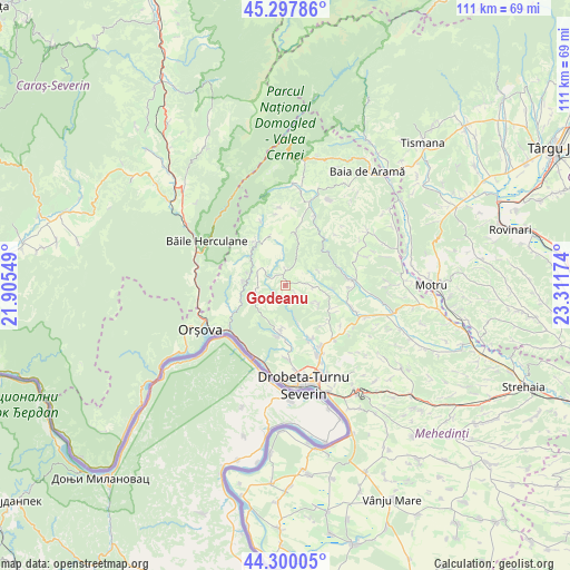
Godeanu GPS coordinates[2]
44° 48' 3.996" North, 22° 36' 30.996" East
| Map corner | latitude | longitude |
|---|---|---|
| Upper-left | 45.29786°, | 21.90549° |
| Center: | 44.80111°, | 22.60861° |
| Lower-right: | 44.30005°, | 23.31174° |
| Map W x H: | 110.9×110.9 km | = 68.9×68.9mi |
| max Lat: | 48.23793° ⇑76.5% North |
| Godeanu: | 44.80111° |
| min Lat: | ⇓23.5% South 43.65638° |
| min Long | Godeanu | max Long |
| 20.31667° | 22.60861° | 29.65403° |
| W 11.1%⇐ | ⇒88.9% E |
Elevation
Elevation of Godeanu is 648 m = 2126 ft, and this is 393.1 m = 1290 ft above average elevation for this country.
| Max E: |
1278 m = 4193 ft | 4.4% |
| Godeanu | 648 m 2126 ft | |
| Avg. | 254.9 m = 836 ft | |
Min E: |
-2 m = -7 ft | 95.6% |
See also: Romania elevation on elevation.city.
Geographical zone
Godeanu is located in North temperate zone (between Tropic of Cancer and the Arctic Circle). Distance of this Northern Tropic circle is 2375.5 km =1476.1 mi to South.| Distance of | km | miles | from Godeanu |
|---|---|---|---|
| North Pole | 5025.6 | 3122.8 | to North |
| Arctic Circle | 2419.8 | 1503.6 | to North |
| Tropic Cancer | 2375.5 | 1476.1 | to South |
| Equator | 4981.4 | 3095.3 | to South |


Nearby cities:
15 places around Godeanu: (largest is in red/bold)
• Balta
9.8 km =6.1 mi,  13°
13°
• Bobaița
10 km =6.2 mi,  117°
117°
• Brezniţa Ocol
15 km =9.3 mi,  177°
177°
• Bâlvăneşti
5.7 km =3.5 mi,  94°
94°
• Cireşu
6.1 km =3.8 mi,  293°
293°
• Crăguești
13.8 km =8.6 mi,  109°
109°
• Halânga
14.8 km =9.2 mi,  154°
154°
• Iloviţa
11.8 km =7.3 mi,  245°
245°
• Ilovăț
12.3 km =7.6 mi,  84°
84°
• Izvoru Bârzii
11.7 km =7.3 mi, 153°
• Jidoștița
9.6 km =6 mi,  187°
187°
• Malovăţ
14.5 km =9 mi,  138°
138°
• Podeni
10.3 km =6.4 mi,  330°
330°
• Pârlagele
7.6 km =4.7 mi, 121°
• Schinteiești
12 km =7.5 mi,  157°
157°
Sources, notices
• [Note1] Compared only with cities in Romania existing in our database
• [Src1] Map data: © OpenStreetMap contributors (CC-BY-SA)
• [Src2] Other city data from geonames.org with taken over terms of usage.
• [Src3] Geographical zone / Annual Mean Temperature by Robert A. Rohde @ Wikipedia
