Iloviţa geodata
Iloviţa (Mehedinţi) is a seat of a second-order administrative division; located in Romania in Europe/Bucharest (GMT+3) time zone. With population of 1,397 people, there are 3336 cities with bigger population in this country. Compared to other cities in Romania, 78.2% of cities are located further ↑North; 90% of cities are located further →East and 75.9% of cities have higher elevation than Iloviţa. Note1


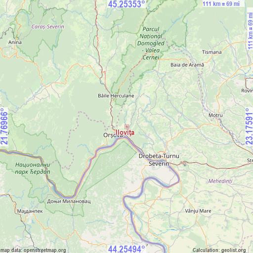
Iloviţa GPS coordinates[2]
44° 45' 23.004" North, 22° 28' 22.008" East
| Map corner | latitude | longitude |
|---|---|---|
| Upper-left | 45.25353°, | 21.76966° |
| Center: | 44.75639°, | 22.47278° |
| Lower-right: | 44.25494°, | 23.17591° |
| Map W x H: | 111×111 km | = 69×69mi |
| max Lat: | 48.23793° ⇑78.2% North |
| Iloviţa: | 44.75639° |
| min Lat: | ⇓21.8% South 43.65638° |
| min Long | Iloviţa | max Long |
| 20.31667° | 22.47278° | 29.65403° |
| W 10%⇐ | ⇒90% E |
Elevation
Elevation of Iloviţa is 107 m = 351 ft, and this is 147.9 m = 485 ft below average elevation for this country.
| Max E: |
1278 m = 4193 ft | 75.9% |
| Avg. | 254.9 m = 836 ft | |
| Iloviţa | 107 m = 351 ft | |
Min E: |
-2 m = -7 ft | 24.1% |
See also: Romania elevation on elevation.city.
Geographical zone
Iloviţa is located in North temperate zone (between Tropic of Cancer and the Arctic Circle). Distance of this Northern Tropic circle is 2370.5 km =1473 mi to South.| Distance of | km | miles | from Iloviţa |
|---|---|---|---|
| North Pole | 5030.6 | 3125.9 | to North |
| Arctic Circle | 2424.7 | 1506.6 | to North |
| Tropic Cancer | 2370.5 | 1473 | to South |
| Equator | 4976.4 | 3092.2 | to South |


Nearby cities:
15 places around Iloviţa: (largest is in red/bold)
• Brezniţa Ocol
15.2 km =9.4 mi,  130°
130°
• Bârza
9.2 km =5.7 mi,  311°
311°
• Băile Herculane
14.5 km =9 mi,  340°
340°
• Cireşu
9.1 km =5.7 mi,  34°
34°
• Dudașu Schelei
16.1 km =10 mi,  142°
142°
• Eşelniţa
10.8 km =6.7 mi,  233°
233°
• Godeanu
11.8 km =7.3 mi,  65°
65°
• Gura Văii
11.9 km =7.4 mi,  146°
146°
• Izvoru Bârzii
16.8 km =10.4 mi,  109°
109°
• Jidoștița
10.5 km =6.5 mi,  115°
115°
• Orşova
7.1 km =4.4 mi,  238°
238°
• Pecinișca
12.7 km =7.9 mi, 335°
• Podeni
15 km =9.3 mi,  21°
21°
• Schinteiești
16.5 km =10.3 mi, 111°
• Topleţ
7.7 km =4.8 mi, 306°
Sources, notices
• [Note1] Compared only with cities in Romania existing in our database
• [Src1] Map data: © OpenStreetMap contributors (CC-BY-SA)
• [Src2] Other city data from geonames.org with taken over terms of usage.
• [Src3] Geographical zone / Annual Mean Temperature by Robert A. Rohde @ Wikipedia
