Mățău geodata
Mățău (Arges) is a populated place; located in Romania in Europe/Bucharest (GMT+3) time zone. With population of 1,105 people, there are 3977 cities with bigger population in this country. Compared to other cities in Romania, 60.6% of cities are located further ↑North; 51.6% of cities are located further →East and 99.3% of cities have lower elevation than Mățău. Note1


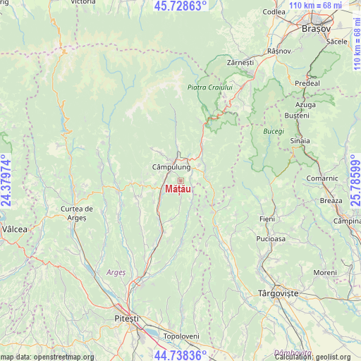
Mățău GPS coordinates[2]
45° 14' 8.34" North, 25° 4' 58.296" East
| Map corner | latitude | longitude |
|---|---|---|
| Upper-left | 45.72863°, | 24.37974° |
| Center: | 45.23565°, | 25.08286° |
| Lower-right: | 44.73836°, | 25.78599° |
| Map W x H: | 110.1×110.1 km | = 68.4×68.4mi |
| max Lat: | 48.23793° ⇑60.6% North |
| Mățău: | 45.23565° |
| min Lat: | ⇓39.4% South 43.65638° |
| min Long | Mățău | max Long |
| 20.31667° | 25.08286° | 29.65403° |
| W 48.4%⇐ | ⇒51.6% E |
Elevation
Elevation of Mățău is 896 m = 2940 ft, and this is 641.1 m = 2103 ft above average elevation for this country.
| Max E: |
1278 m = 4193 ft | 0.7% |
| Mățău | 896 m 2940 ft | |
| Avg. | 254.9 m = 836 ft | |
Min E: |
-2 m = -7 ft | 99.3% |
See also: Romania elevation on elevation.city.
Geographical zone
Mățău is located in North temperate zone (between Tropic of Cancer and the Arctic Circle). Distance of this North polar circle is 2371.4 km =1473.5 mi to North.| Distance of | km | miles | from Mățău |
|---|---|---|---|
| North Pole | 4977.3 | 3092.7 | to North |
| Arctic Circle | 2371.4 | 1473.5 | to North |
| Tropic Cancer | 2423.8 | 1506.1 | to South |
| Equator | 5029.7 | 3125.3 | to South |


Nearby cities:
15 places around Mățău: (largest is in red/bold)
• Boteni
6.4 km =4 mi,  155°
155°
• Bughea de Jos
7.3 km =4.5 mi,  298°
298°
• Bădeni
7.7 km =4.8 mi,  83°
83°
• Câmpulung
4.3 km =2.7 mi,  323°
323°
• Groșani
3.9 km =2.4 mi,  257°
257°
• Jugur
4.8 km =3 mi,  178°
178°
• Lunca
7.8 km =4.8 mi,  154°
154°
• Piatra
7.2 km =4.5 mi,  50°
50°
• Poienari
3.3 km =2.1 mi,  230°
230°
• Schitu-Goleşti
7.6 km =4.7 mi,  238°
238°
• Stoeneşti
6.8 km =4.2 mi, 76°
• Suslănești
3 km =1.9 mi, 81°
• Valea Mare Pravăț
6.3 km =3.9 mi,  6°
6°
• Valea Pechii
7.4 km =4.6 mi, 227°
• Voinești
7.2 km =4.5 mi,  353°
353°
Sources, notices
• [Note1] Compared only with cities in Romania existing in our database
• [Src1] Map data: © OpenStreetMap contributors (CC-BY-SA)
• [Src2] Other city data from geonames.org with taken over terms of usage.
• [Src3] Geographical zone / Annual Mean Temperature by Robert A. Rohde @ Wikipedia
