Liebling geodata
Liebling (Timiş) is a seat of a second-order administrative division; located in Romania in Europe/Bucharest (GMT+3) time zone. With population of 3,705 people, there are 1322 cities with bigger population in this country. Compared to other cities in Romania, 53.9% of cities are located further ↑North; 98.3% of cities are located further →East and 81.4% of cities have higher elevation than Liebling. Note1


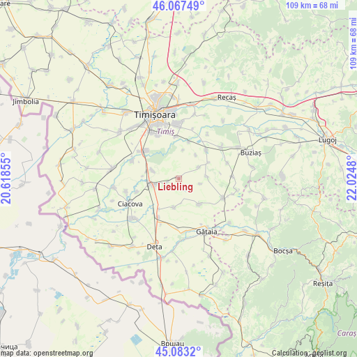
Liebling GPS coordinates[2]
45° 34' 39" North, 21° 19' 18.012" East
| Map corner | latitude | longitude |
|---|---|---|
| Upper-left | 46.06749°, | 20.61855° |
| Center: | 45.5775°, | 21.32167° |
| Lower-right: | 45.0832°, | 22.0248° |
| Map W x H: | 109.4×109.4 km | = 68×68mi |
| max Lat: | 48.23793° ⇑53.9% North |
| Liebling: | 45.5775° |
| min Lat: | ⇓46.1% South 43.65638° |
| min Long | Liebling | max Long |
| 20.31667° | 21.32167° | 29.65403° |
| W 1.7%⇐ | ⇒98.3% E |
Elevation
Elevation of Liebling is 90 m = 295 ft, and this is 164.9 m = 541 ft below average elevation for this country.
| Max E: |
1278 m = 4193 ft | 81.4% |
| Avg. | 254.9 m = 836 ft | |
| Liebling | 90 m = 295 ft | |
Min E: |
-2 m = -7 ft | 18.6% |
See also: Romania elevation on elevation.city.
Geographical zone
Liebling is located in North temperate zone (between Tropic of Cancer and the Arctic Circle). Distance of this North polar circle is 2333.4 km =1449.9 mi to North.| Distance of | km | miles | from Liebling |
|---|---|---|---|
| North Pole | 4939.3 | 3069.1 | to North |
| Arctic Circle | 2333.4 | 1449.9 | to North |
| Tropic Cancer | 2461.8 | 1529.7 | to South |
| Equator | 5067.7 | 3148.9 | to South |


Nearby cities:
15 places around Liebling: (largest is in red/bold)
• Chevereşu Mare
16.5 km =10.3 mi,  52°
52°
• Chișoda
16.3 km =10.1 mi,  329°
329°
• Giroc
14.6 km =9.1 mi, 332°
• Jebel
8.8 km =5.5 mi,  253°
253°
• Moşniţa Nouă
15.5 km =9.6 mi,  1°
1°
• Obad
13.5 km =8.4 mi, 252°
• Parța
15.3 km =9.5 mi,  291°
291°
• Pădureni
8.5 km =5.3 mi, 287°
• Sacoşu Turcesc
11.7 km =7.3 mi, 45°
• Tormac
14.8 km =9.2 mi,  115°
115°
• Uliuc
11.5 km =7.1 mi,  15°
15°
• Urseni
12.8 km =8 mi,  355°
355°
• Voiteg
13.7 km =8.5 mi,  208°
208°
• Şag
13.8 km =8.6 mi,  304°
304°
• Șipet
9.9 km =6.2 mi,  141°
141°
Sources, notices
• [Note1] Compared only with cities in Romania existing in our database
• [Src1] Map data: © OpenStreetMap contributors (CC-BY-SA)
• [Src2] Other city data from geonames.org with taken over terms of usage.
• [Src3] Geographical zone / Annual Mean Temperature by Robert A. Rohde @ Wikipedia
