Bâlvăneşti geodata
Bâlvăneşti (Mehedinţi) is a seat of a second-order administrative division; located in Romania in Europe/Bucharest (GMT+3) time zone. With population of 1,131 people, there are 3899 cities with bigger population in this country. Compared to other cities in Romania, 76.8% of cities are located further ↑North; 88.4% of cities are located further →East and 90.4% of cities have lower elevation than Bâlvăneşti. Note1


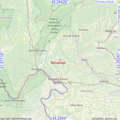
Bâlvăneşti GPS coordinates[2]
44° 47' 51" North, 22° 40' 49.008" East
| Map corner | latitude | longitude |
|---|---|---|
| Upper-left | 45.29428°, | 21.97716° |
| Center: | 44.7975°, | 22.68028° |
| Lower-right: | 44.2964°, | 23.38341° |
| Map W x H: | 111×111 km | = 69×69mi |
| max Lat: | 48.23793° ⇑76.8% North |
| Bâlvăneşti: | 44.7975° |
| min Lat: | ⇓23.2% South 43.65638° |
| min Long | Bâlvăneşti | max Long |
| 20.31667° | 22.68028° | 29.65403° |
| W 11.6%⇐ | ⇒88.4% E |
Elevation
Elevation of Bâlvăneşti is 520 m = 1706 ft, and this is 265.1 m = 870 ft above average elevation for this country.
| Max E: |
1278 m = 4193 ft | 9.6% |
| Bâlvăneşti | 520 m 1706 ft | |
| Avg. | 254.9 m = 836 ft | |
Min E: |
-2 m = -7 ft | 90.4% |
See also: Romania elevation on elevation.city.
Geographical zone
Bâlvăneşti is located in North temperate zone (between Tropic of Cancer and the Arctic Circle). Distance of this Northern Tropic circle is 2375.1 km =1475.8 mi to South.| Distance of | km | miles | from Bâlvăneşti |
|---|---|---|---|
| North Pole | 5026 | 3123 | to North |
| Arctic Circle | 2420.2 | 1503.8 | to North |
| Tropic Cancer | 2375.1 | 1475.8 | to South |
| Equator | 4981 | 3095 | to South |


Nearby cities:
15 places around Bâlvăneşti: (largest is in red/bold)
• Balta
10.5 km =6.5 mi,  341°
341°
• Bobaița
5.3 km =3.3 mi,  142°
142°
• Cireşu
11.6 km =7.2 mi,  284°
284°
• Crăguești
8.4 km =5.2 mi,  119°
119°
• Godeanu
5.7 km =3.5 mi,  274°
274°
• Halânga
13 km =8.1 mi,  176°
176°
• Ilovăț
6.7 km =4.2 mi,  76°
76°
• Izvoru Bârzii
10.1 km =6.3 mi, 182°
• Jidoștița
11.4 km =7.1 mi,  217°
217°
• Malovăţ
11.1 km =6.9 mi,  158°
158°
• Pârlagele
3.6 km =2.2 mi,  166°
166°
• Rudina
12.9 km =8 mi,  44°
44°
• Schinteiești
10.8 km =6.7 mi,  185°
185°
• Şişeşti
12.8 km =8 mi,  100°
100°
• Şovarna
10.8 km =6.7 mi,  54°
54°
Sources, notices
• [Note1] Compared only with cities in Romania existing in our database
• [Src1] Map data: © OpenStreetMap contributors (CC-BY-SA)
• [Src2] Other city data from geonames.org with taken over terms of usage.
• [Src3] Geographical zone / Annual Mean Temperature by Robert A. Rohde @ Wikipedia
