Dângeni geodata
Dângeni (Botoşani) is a seat of a second-order administrative division; located in Romania in Europe/Bucharest (GMT+3) time zone. With population of 3,094 people, there are 1697 cities with bigger population in this country. Compared to other cities in Romania, 97.4% of cities are located further ↓South; 82.3% of cities are located further ←West and 82.8% of cities have higher elevation than Dângeni. Note1


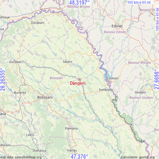
Dângeni GPS coordinates[2]
47° 51' 0" North, 26° 58' 0.012" East
| Map corner | latitude | longitude |
|---|---|---|
| Upper-left | 48.3197°, | 26.26355° |
| Center: | 47.85°, | 26.96667° |
| Lower-right: | 47.376°, | 27.6698° |
| Map W x H: | 104.9×104.9 km | = 65.2×65.2mi |
| max Lat: | 48.23793° ⇑2.6% North |
| Dângeni: | 47.85° |
| min Lat: | ⇓97.4% South 43.65638° |
| min Long | Dângeni | max Long |
| 20.31667° | 26.96667° | 29.65403° |
| W 82.3%⇐ | ⇒17.7% E |
Elevation
Elevation of Dângeni is 85 m = 279 ft, and this is 169.9 m = 557 ft below average elevation for this country.
| Max E: |
1278 m = 4193 ft | 82.8% |
| Avg. | 254.9 m = 836 ft | |
| Dângeni | 85 m = 279 ft | |
Min E: |
-2 m = -7 ft | 17.2% |
See also: Romania elevation on elevation.city.
Geographical zone
Dângeni is located in North temperate zone (between Tropic of Cancer and the Arctic Circle). Distance of this North polar circle is 2080.8 km =1292.9 mi to North.| Distance of | km | miles | from Dângeni |
|---|---|---|---|
| North Pole | 4686.6 | 2912.1 | to North |
| Arctic Circle | 2080.8 | 1292.9 | to North |
| Tropic Cancer | 2714.5 | 1686.7 | to South |
| Equator | 5320.4 | 3305.9 | to South |


Nearby cities:
15 places around Dângeni: (largest is in red/bold)
• Brăteni
4.2 km =2.6 mi,  72°
72°
• Buhăceni
4.8 km =3 mi,  149°
149°
• Dobârceni
8.3 km =5.2 mi,  116°
116°
• Drislea
8.8 km =5.5 mi,  177°
177°
• Gorbăneşti
11.4 km =7.1 mi,  229°
229°
• Guranda
11.1 km =6.9 mi,  136°
136°
• Hulub
2.7 km =1.7 mi, 182°
• Hăneşti
7.5 km =4.7 mi,  9°
9°
• Iacobeni
4.2 km =2.6 mi,  287°
287°
• Mihălăşeni
8.3 km =5.2 mi,  63°
63°
• Socrujeni
8.5 km =5.3 mi,  208°
208°
• Sârbi
10.9 km =6.8 mi,  340°
340°
• Truşeşti
10 km =6.2 mi,  158°
158°
• Vicoleni
9.4 km =5.8 mi, 290°
• Vlăsineşti
11.2 km =7 mi,  326°
326°
Sources, notices
• [Note1] Compared only with cities in Romania existing in our database
• [Src1] Map data: © OpenStreetMap contributors (CC-BY-SA)
• [Src2] Other city data from geonames.org with taken over terms of usage.
• [Src3] Geographical zone / Annual Mean Temperature by Robert A. Rohde @ Wikipedia
