Fulga de Jos geodata
Fulga de Jos (Prahova) is a populated place; located in Romania in Europe/Bucharest (GMT+3) time zone. With population of 1,823 people, there are 2802 cities with bigger population in this country. Compared to other cities in Romania, 73.8% of cities are located further ↑North; 71.5% of cities are located further ←West and 84.7% of cities have higher elevation than Fulga de Jos. Note1


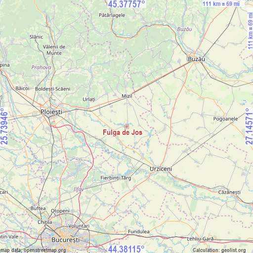
Fulga de Jos GPS coordinates[2]
44° 52' 53.472" North, 26° 26' 33.288" East
| Map corner | latitude | longitude |
|---|---|---|
| Upper-left | 45.37757°, | 25.73946° |
| Center: | 44.88152°, | 26.44258° |
| Lower-right: | 44.38115°, | 27.14571° |
| Map W x H: | 110.8×110.8 km | = 68.8×68.8mi |
| max Lat: | 48.23793° ⇑73.8% North |
| Fulga de Jos: | 44.88152° |
| min Lat: | ⇓26.2% South 43.65638° |
| min Long | Fulga de Jos | max Long |
| 20.31667° | 26.44258° | 29.65403° |
| W 71.5%⇐ | ⇒28.5% E |
Elevation
Elevation of Fulga de Jos is 79 m = 259 ft, and this is 175.9 m = 577 ft below average elevation for this country.
| Max E: |
1278 m = 4193 ft | 84.7% |
| Avg. | 254.9 m = 836 ft | |
| Fulga de Jos | 79 m = 259 ft | |
Min E: |
-2 m = -7 ft | 15.3% |
See also: Romania elevation on elevation.city.
Geographical zone
Fulga de Jos is located in North temperate zone (between Tropic of Cancer and the Arctic Circle). Distance of this Northern Tropic circle is 2384.4 km =1481.6 mi to South.| Distance of | km | miles | from Fulga de Jos |
|---|---|---|---|
| North Pole | 5016.7 | 3117.2 | to North |
| Arctic Circle | 2410.8 | 1498 | to North |
| Tropic Cancer | 2384.4 | 1481.6 | to South |
| Equator | 4990.4 | 3100.9 | to South |


Nearby cities:
15 places around Fulga de Jos: (largest is in red/bold)
• Baba Ana
9.5 km =5.9 mi,  3°
3°
• Boldeşti
8.6 km =5.3 mi,  101°
101°
• Bărăitaru
7.6 km =4.7 mi,  252°
252°
• Cioranii de Jos
7.5 km =4.7 mi,  195°
195°
• Cioranii de Sus
6 km =3.7 mi,  218°
218°
• Colceag
10.5 km =6.5 mi,  316°
316°
• Conduratu
10.1 km =6.3 mi,  356°
356°
• Fulga de Sus
2.1 km =1.3 mi,  15°
15°
• Gradiștea
5.8 km =3.6 mi,  82°
82°
• Inotești
11.1 km =6.9 mi, 323°
• Meri
11.8 km =7.3 mi,  243°
243°
• Parepa-Rușani
7.4 km =4.6 mi,  291°
291°
• Slătioarele
12.1 km =7.5 mi,  151°
151°
• Sălciile
7.9 km =4.9 mi,  155°
155°
• Vâlcelele
8 km =5 mi, 322°
Sources, notices
• [Note1] Compared only with cities in Romania existing in our database
• [Src1] Map data: © OpenStreetMap contributors (CC-BY-SA)
• [Src2] Other city data from geonames.org with taken over terms of usage.
• [Src3] Geographical zone / Annual Mean Temperature by Robert A. Rohde @ Wikipedia
