Cârlibaba geodata
Cârlibaba (Suceava) is a seat of a second-order administrative division; located in Romania in Europe/Bucharest (GMT+3) time zone. With population of 1,965 people, there are 2638 cities with bigger population in this country. Compared to other cities in Romania, 92.7% of cities are located further ↓South; 51% of cities are located further →East and 99.9% of cities have lower elevation than Cârlibaba. Note1


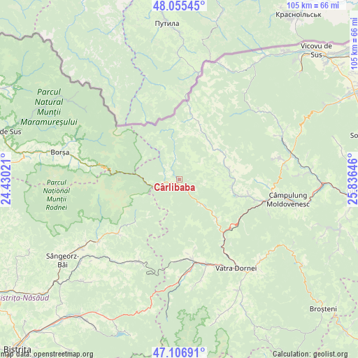
Cârlibaba GPS coordinates[2]
47° 34' 59.988" North, 25° 7' 59.988" East
| Map corner | latitude | longitude |
|---|---|---|
| Upper-left | 48.05545°, | 24.43021° |
| Center: | 47.58333°, | 25.13333° |
| Lower-right: | 47.10691°, | 25.83646° |
| Map W x H: | 105.5×105.5 km | = 65.6×65.6mi |
| max Lat: | 48.23793° ⇑7.3% North |
| Cârlibaba: | 47.58333° |
| min Lat: | ⇓92.7% South 43.65638° |
| min Long | Cârlibaba | max Long |
| 20.31667° | 25.13333° | 29.65403° |
| W 49%⇐ | ⇒51% E |
Elevation
Elevation of Cârlibaba is 1134 m = 3720 ft, and this is 879.1 m = 2884 ft above average elevation for this country.
| Max E: |
1278 m = 4193 ft | 0.099999999999994% |
| Cârlibaba | 1134 m 3720 ft | |
| Avg. | 254.9 m = 836 ft | |
Min E: |
-2 m = -7 ft | 99.9% |
See also: Romania elevation on elevation.city.
Geographical zone
Cârlibaba is located in North temperate zone (between Tropic of Cancer and the Arctic Circle). Distance of this North polar circle is 2110.4 km =1311.3 mi to North.| Distance of | km | miles | from Cârlibaba |
|---|---|---|---|
| North Pole | 4716.3 | 2930.6 | to North |
| Arctic Circle | 2110.4 | 1311.3 | to North |
| Tropic Cancer | 2684.9 | 1668.3 | to South |
| Equator | 5290.8 | 3287.5 | to South |


Nearby cities:
15 places around Cârlibaba: (largest is in red/bold)
• Benia
13.5 km =8.4 mi,  47°
47°
• Bobeica
15.9 km =9.9 mi,  0°
0°
• Botuș
15.9 km =9.9 mi,  99°
99°
• Breaza
14.3 km =8.9 mi,  75°
75°
• Brodina
24.3 km =15.1 mi,  25°
25°
• Ciocănești
15.8 km =9.8 mi,  136°
136°
• Colacu
18.6 km =11.6 mi,  105°
105°
• Coșna
23.9 km =14.9 mi,  171°
171°
• Dealu Floreni
25.8 km =16 mi,  163°
163°
• Fundu Moldovei
20.8 km =12.9 mi, 105°
• Iacobeni
21.6 km =13.4 mi, 140°
• Izvoarele Sucevei
18.9 km =11.7 mi,  11°
11°
• Moldova Suliţa
14.1 km =8.8 mi,  38°
38°
• Pojorâta
24.9 km =15.5 mi, 107°
• Șanț
23 km =14.3 mi,  229°
229°
Sources, notices
• [Note1] Compared only with cities in Romania existing in our database
• [Src1] Map data: © OpenStreetMap contributors (CC-BY-SA)
• [Src2] Other city data from geonames.org with taken over terms of usage.
• [Src3] Geographical zone / Annual Mean Temperature by Robert A. Rohde @ Wikipedia
