Šid geodata
Šid (Vojvodina) is a seat of a third-order administrative division; located in Serbia in Europe/Belgrade (GMT+2) time zone. In our database, there are 365 cities with bigger population. Compared to other cities in Serbia, 65.1% of cities are located further ↓South; 97.1% of cities are located further →East and 56.7% of cities have lower elevation than Šid. Note1


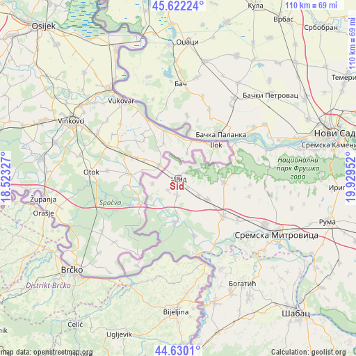
Šid GPS coordinates[2]
45° 7' 41.988" North, 19° 13' 35.004" East
| Map corner | latitude | longitude |
|---|---|---|
| Upper-left | 45.62224°, | 18.52327° |
| Center: | 45.12833°, | 19.22639° |
| Lower-right: | 44.6301°, | 19.92952° |
| Map W x H: | 110.3×110.3 km | = 68.5×68.5mi |
| max Lat: | 46.1° ⇑34.9% North |
| Šid: | 45.12833° |
| min Lat: | ⇓65.1% South 42.25846° |
| min Long | Šid | max Long |
| 18.9276° | 19.22639° | 22.77556° |
| W 2.9%⇐ | ⇒97.1% E |
Elevation
Elevation of Šid is 104 m = 341 ft, and this is 72.4 m = 238 ft below average elevation for this country.
| Max E: |
1421 m = 4662 ft | 43.3% |
| Avg. | 176.4 m = 579 ft | |
| Šid | 104 m = 341 ft | |
Min E: |
49 m = 161 ft | 56.7% |
See also: Serbia elevation on elevation.city.
Geographical zone
Šid is located in North temperate zone (between Tropic of Cancer and the Arctic Circle). Distance of this North polar circle is 2383.4 km =1481 mi to North.| Distance of | km | miles | from Šid |
|---|---|---|---|
| North Pole | 4989.3 | 3100.2 | to North |
| Arctic Circle | 2383.4 | 1481 | to North |
| Tropic Cancer | 2411.9 | 1498.7 | to South |
| Equator | 5017.8 | 3117.9 | to South |


Nearby cities:
15 places around Šid: (largest is in red/bold)
• Banovo Polje
29.9 km =18.6 mi,  144°
144°
• Bač
29.3 km =18.2 mi,  1°
1°
• Bačka Palanka
19 km =11.8 mi,  44°
44°
• Bosut
24.5 km =15.2 mi,  154°
154°
• Crna Bara
31.3 km =19.4 mi, 154°
• Glogovac
33 km =20.5 mi, 153°
• Gložan
31.6 km =19.6 mi,  57°
57°
• Mačvanska Mitrovica
33.9 km =21.1 mi,  121°
121°
• Obrovac
23.5 km =14.6 mi,  24°
24°
• Radenković
31.2 km =19.4 mi, 137°
• Ravnje
25.7 km =16 mi, 143°
• Sremska Rača
23.5 km =14.6 mi,  168°
168°
• Višnjićevo
18.6 km =11.6 mi,  164°
164°
• Zasavica Prva
28.3 km =17.6 mi,  133°
133°
• Čelarevo
28.2 km =17.5 mi, 56°
Sources, notices
• [Note1] Compared only with cities in Serbia existing in our database
• [Src1] Map data: © OpenStreetMap contributors (CC-BY-SA)
• [Src2] Other city data from geonames.org with taken over terms of usage.
• [Src3] Geographical zone / Annual Mean Temperature by Robert A. Rohde @ Wikipedia
