Ljubovija geodata
Ljubovija (Central Serbia) is a seat of a third-order administrative division; located in Serbia in Europe/Belgrade (GMT+2) time zone. With population of 2,717 people, there are 165 cities with bigger population in this country. Compared to other cities in Serbia, 77.6% of cities are located further ↑North; 92.7% of cities are located further →East and 72.6% of cities have lower elevation than Ljubovija. Note1


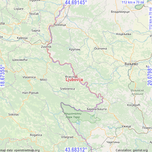
Ljubovija GPS coordinates[2]
44° 11' 21.984" North, 19° 22' 36.012" East
| Map corner | latitude | longitude |
|---|---|---|
| Upper-left | 44.69145°, | 18.67355° |
| Center: | 44.18944°, | 19.37667° |
| Lower-right: | 43.68312°, | 20.0798° |
| Map W x H: | 112.1×112.1 km | = 69.7×69.7mi |
| max Lat: | 46.1° ⇑77.6% North |
| Ljubovija: | 44.18944° |
| min Lat: | ⇓22.4% South 42.25846° |
| min Long | Ljubovija | max Long |
| 18.9276° | 19.37667° | 22.77556° |
| W 7.3%⇐ | ⇒92.7% E |
Elevation
Elevation of Ljubovija is 178 m = 584 ft, and this is 1.6 m = 5 ft above average elevation for this country.
| Max E: |
1421 m = 4662 ft | 27.4% |
| Ljubovija | 178 m 584 ft | |
| Avg. | 176.4 m = 579 ft | |
Min E: |
49 m = 161 ft | 72.6% |
See also: Serbia elevation on elevation.city.
Geographical zone
Ljubovija is located in North temperate zone (between Tropic of Cancer and the Arctic Circle). Distance of this Northern Tropic circle is 2307.5 km =1433.8 mi to South.| Distance of | km | miles | from Ljubovija |
|---|---|---|---|
| North Pole | 5093.7 | 3165.1 | to North |
| Arctic Circle | 2487.8 | 1545.8 | to North |
| Tropic Cancer | 2307.5 | 1433.8 | to South |
| Equator | 4913.4 | 3053 | to South |


Nearby cities:
15 places around Ljubovija: (largest is in red/bold)
• Bajina Bašta
28.7 km =17.8 mi,  147°
147°
• Bukor
37.4 km =23.2 mi,  24°
24°
• Donja Badanja
36 km =22.4 mi,  12°
12°
• Gornja Bukovica
38.6 km =24 mi,  64°
64°
• Gornje Nedeljice
36.5 km =22.7 mi,  355°
355°
• Grnčara
38.9 km =24.2 mi,  350°
350°
• Jarebice
39.2 km =24.4 mi, 5°
• Kamenica
32.5 km =20.2 mi, 58°
• Krupanj
19.6 km =12.2 mi, 356°
• Mali Zvornik
29.7 km =18.5 mi,  313°
313°
• Osečina
27.1 km =16.8 mi,  41°
41°
• Tekeriš
42.7 km =26.5 mi, 16°
• Tršić
35.1 km =21.8 mi, 345°
• Valjevo
42.6 km =26.5 mi,  77°
77°
• Ðurići
40.6 km =25.2 mi,  175°
175°
Sources, notices
• [Note1] Compared only with cities in Serbia existing in our database
• [Src1] Map data: © OpenStreetMap contributors (CC-BY-SA)
• [Src2] Other city data from geonames.org with taken over terms of usage.
• [Src3] Geographical zone / Annual Mean Temperature by Robert A. Rohde @ Wikipedia
