Bajina Bašta geodata
Bajina Bašta (Central Serbia) is a seat of a third-order administrative division; located in Serbia in Europe/Belgrade (GMT+2) time zone. With population of 8,533 people, there are 59 cities with bigger population in this country. Compared to other cities in Serbia, 79.8% of cities are located further ↑North; 85.3% of cities are located further →East and 80.7% of cities have lower elevation than Bajina Bašta. Note1


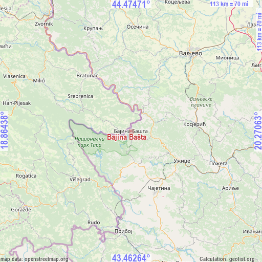
Bajina Bašta GPS coordinates[2]
43° 58' 14.988" North, 19° 34' 3" East
| Map corner | latitude | longitude |
|---|---|---|
| Upper-left | 44.47471°, | 18.86438° |
| Center: | 43.97083°, | 19.5675° |
| Lower-right: | 43.46264°, | 20.27063° |
| Map W x H: | 112.5×112.5 km | = 69.9×69.9mi |
| max Lat: | 46.1° ⇑79.8% North |
| Bajina Bašta: | 43.97083° |
| min Lat: | ⇓20.2% South 42.25846° |
| min Long | Bajina Bašta | max Long |
| 18.9276° | 19.5675° | 22.77556° |
| W 14.7%⇐ | ⇒85.3% E |
Elevation
Elevation of Bajina Bašta is 242 m = 794 ft, and this is 65.6 m = 215 ft above average elevation for this country.
| Max E: |
1421 m = 4662 ft | 19.3% |
| Bajina Bašta | 242 m 794 ft | |
| Avg. | 176.4 m = 579 ft | |
Min E: |
49 m = 161 ft | 80.7% |
See also: Serbia elevation on elevation.city.
Geographical zone
Bajina Bašta is located in North temperate zone (between Tropic of Cancer and the Arctic Circle). Distance of this Northern Tropic circle is 2283.2 km =1418.7 mi to South.| Distance of | km | miles | from Bajina Bašta |
|---|---|---|---|
| North Pole | 5118 | 3180.2 | to North |
| Arctic Circle | 2512.1 | 1560.9 | to North |
| Tropic Cancer | 2283.2 | 1418.7 | to South |
| Equator | 4889.1 | 3037.9 | to South |


Nearby cities:
15 places around Bajina Bašta: (largest is in red/bold)
• Gornja Bukovica
45.5 km =28.3 mi,  25°
25°
• Kamenica
43.2 km =26.8 mi,  16°
16°
• Kosjerić
27.3 km =17 mi,  84°
84°
• Krupanj
46.9 km =29.1 mi,  339°
339°
• Ljubovija
28.7 km =17.8 mi,  327°
327°
• Lučani
47.3 km =29.4 mi,  104°
104°
• Mokra Gora
21 km =13 mi,  194°
194°
• Osečina
44.8 km =27.8 mi,  3°
3°
• Požega
39.9 km =24.8 mi,  109°
109°
• Priboj
43.2 km =26.8 mi,  184°
184°
• Užice
25.8 km =16 mi,  118°
118°
• Valjevo
42.9 km =26.7 mi,  37°
37°
• Zlatibor
28.9 km =18 mi,  158°
158°
• Ðurići
20.4 km =12.7 mi,  217°
217°
• Čajetina
27.2 km =16.9 mi,  154°
154°
Sources, notices
• [Note1] Compared only with cities in Serbia existing in our database
• [Src1] Map data: © OpenStreetMap contributors (CC-BY-SA)
• [Src2] Other city data from geonames.org with taken over terms of usage.
• [Src3] Geographical zone / Annual Mean Temperature by Robert A. Rohde @ Wikipedia
