Bukor geodata
Bukor (Central Serbia) is a populated locality; located in Serbia in Europe/Belgrade (GMT+2) time zone. With population of 1,167 people, there are 304 cities with bigger population in this country. Compared to other cities in Serbia, 71.2% of cities are located further ↑North; 84.8% of cities are located further →East and 81.6% of cities have lower elevation than Bukor. Note1


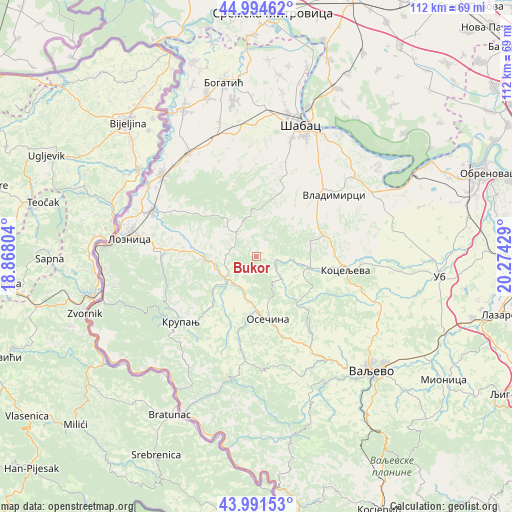
Bukor GPS coordinates[2]
44° 29' 42.828" North, 19° 34' 16.176" East
| Map corner | latitude | longitude |
|---|---|---|
| Upper-left | 44.99462°, | 18.86804° |
| Center: | 44.49523°, | 19.57116° |
| Lower-right: | 43.99153°, | 20.27429° |
| Map W x H: | 111.5×111.5 km | = 69.3×69.3mi |
| max Lat: | 46.1° ⇑71.2% North |
| Bukor: | 44.49523° |
| min Lat: | ⇓28.8% South 42.25846° |
| min Long | Bukor | max Long |
| 18.9276° | 19.57116° | 22.77556° |
| W 15.2%⇐ | ⇒84.8% E |
Elevation
Elevation of Bukor is 252 m = 827 ft, and this is 75.6 m = 248 ft above average elevation for this country.
| Max E: |
1421 m = 4662 ft | 18.4% |
| Bukor | 252 m 827 ft | |
| Avg. | 176.4 m = 579 ft | |
Min E: |
49 m = 161 ft | 81.6% |
See also: Serbia elevation on elevation.city.
Geographical zone
Bukor is located in North temperate zone (between Tropic of Cancer and the Arctic Circle). Distance of this Northern Tropic circle is 2341.5 km =1454.9 mi to South.| Distance of | km | miles | from Bukor |
|---|---|---|---|
| North Pole | 5059.7 | 3144 | to North |
| Arctic Circle | 2453.8 | 1524.7 | to North |
| Tropic Cancer | 2341.5 | 1454.9 | to South |
| Equator | 4947.4 | 3074.2 | to South |


Nearby cities:
15 places around Bukor: (largest is in red/bold)
• Belotić
15.1 km =9.4 mi,  50°
50°
• Brdarica
17.2 km =10.7 mi,  67°
67°
• Culjković
19.1 km =11.9 mi,  353°
353°
• Donja Badanja
7.7 km =4.8 mi,  278°
278°
• Draginje
15.7 km =9.8 mi, 74°
• Gornje Nedeljice
18.5 km =11.5 mi, 277°
• Jarebice
12.7 km =7.9 mi,  293°
293°
• Joševa
16.4 km =10.2 mi,  308°
308°
• Krivaja
6.3 km =3.9 mi,  14°
14°
• Mrovska
9.8 km =6.1 mi,  57°
57°
• Nakučani
14 km =8.7 mi,  32°
32°
• Osečina
13.8 km =8.6 mi,  169°
169°
• Rumska
8.7 km =5.4 mi, 9°
• Sinošević
14.3 km =8.9 mi,  21°
21°
• Tekeriš
7.6 km =4.7 mi,  334°
334°
Sources, notices
• [Note1] Compared only with cities in Serbia existing in our database
• [Src1] Map data: © OpenStreetMap contributors (CC-BY-SA)
• [Src2] Other city data from geonames.org with taken over terms of usage.
• [Src3] Geographical zone / Annual Mean Temperature by Robert A. Rohde @ Wikipedia
