Ðurići geodata
Ðurići (Central Serbia) is a populated place; located in Serbia in Europe/Belgrade (GMT+2) time zone. With population of 1,081 people, there are 309 cities with bigger population in this country. Compared to other cities in Serbia, 82.8% of cities are located further ↑North; 91.2% of cities are located further →East and 98.4% of cities have lower elevation than Ðurići. Note1


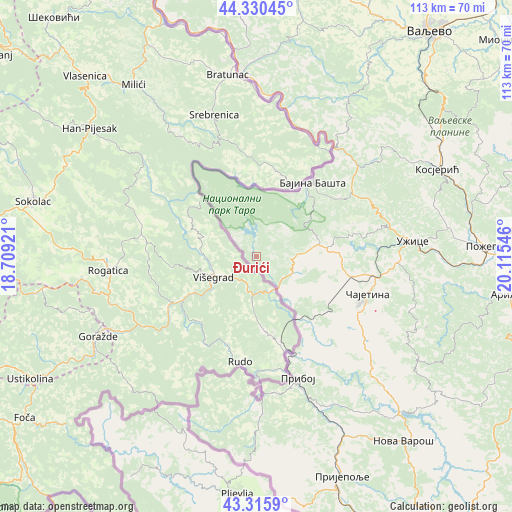
Ðurići GPS coordinates[2]
43° 49' 31.188" North, 19° 24' 44.388" East
| Map corner | latitude | longitude |
|---|---|---|
| Upper-left | 44.33045°, | 18.70921° |
| Center: | 43.82533°, | 19.41233° |
| Lower-right: | 43.3159°, | 20.11546° |
| Map W x H: | 112.8×112.8 km | = 70.1×70.1mi |
| max Lat: | 46.1° ⇑82.8% North |
| Ðurići: | 43.82533° |
| min Lat: | ⇓17.2% South 42.25846° |
| min Long | Ðurići | max Long |
| 18.9276° | 19.41233° | 22.77556° |
| W 8.8%⇐ | ⇒91.2% E |
Elevation
Elevation of Ðurići is 981 m = 3219 ft, and this is 804.6 m = 2640 ft above average elevation for this country.
| Max E: |
1421 m = 4662 ft | 1.6% |
| Ðurići | 981 m 3219 ft | |
| Avg. | 176.4 m = 579 ft | |
Min E: |
49 m = 161 ft | 98.4% |
See also: Serbia elevation on elevation.city.
Geographical zone
Ðurići is located in North temperate zone (between Tropic of Cancer and the Arctic Circle). Distance of this Northern Tropic circle is 2267 km =1408.6 mi to South.| Distance of | km | miles | from Ðurići |
|---|---|---|---|
| North Pole | 5134.1 | 3190.2 | to North |
| Arctic Circle | 2528.3 | 1571 | to North |
| Tropic Cancer | 2267 | 1408.6 | to South |
| Equator | 4872.9 | 3027.9 | to South |


Nearby cities:
15 places around Ðurići: (largest is in red/bold)
• Arilje
55.4 km =34.4 mi,  98°
98°
• Bajina Bašta
20.4 km =12.7 mi,  37°
37°
• Kosjerić
43.9 km =27.3 mi,  64°
64°
• Krupanj
60.2 km =37.4 mi,  356°
356°
• Ljubovija
40.6 km =25.2 mi, 355°
• Lučani
58.3 km =36.2 mi,  86°
86°
• Mokra Gora
8.2 km =5.1 mi,  120°
120°
• Nova Varoš
51.7 km =32.1 mi,  141°
141°
• Osečina
62.7 km =39 mi,  13°
13°
• Požega
50.1 km =31.1 mi, 87°
• Priboj
28.4 km =17.6 mi,  161°
161°
• Prijepolje
52 km =32.3 mi, 158°
• Užice
35.2 km =21.9 mi,  83°
83°
• Zlatibor
25.5 km =15.8 mi,  114°
114°
• Čajetina
25.5 km =15.8 mi, 109°
Sources, notices
• [Note1] Compared only with cities in Serbia existing in our database
• [Src1] Map data: © OpenStreetMap contributors (CC-BY-SA)
• [Src2] Other city data from geonames.org with taken over terms of usage.
• [Src3] Geographical zone / Annual Mean Temperature by Robert A. Rohde @ Wikipedia
