Stara Pazova geodata
Stara Pazova (Vojvodina) is a seat of a third-order administrative division; located in Serbia in Europe/Belgrade (GMT+2) time zone. With population of 16,217 people, there are 45 cities with bigger population in this country. Compared to other cities in Serbia, 57.1% of cities are located further ↓South; 60.3% of cities are located further →East and 63.3% of cities have higher elevation than Stara Pazova. Note1


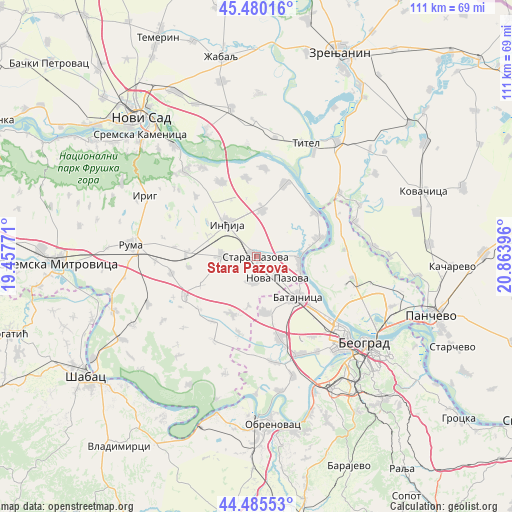
Stara Pazova GPS coordinates[2]
44° 59' 6" North, 20° 9' 38.988" East
| Map corner | latitude | longitude |
|---|---|---|
| Upper-left | 45.48016°, | 19.45771° |
| Center: | 44.985°, | 20.16083° |
| Lower-right: | 44.48553°, | 20.86396° |
| Map W x H: | 110.6×110.6 km | = 68.7×68.7mi |
| max Lat: | 46.1° ⇑42.9% North |
| Stara Pazova: | 44.985° |
| min Lat: | ⇓57.1% South 42.25846° |
| min Long | Stara Pazova | max Long |
| 18.9276° | 20.16083° | 22.77556° |
| W 39.7%⇐ | ⇒60.3% E |
Elevation
Elevation of Stara Pazova is 81 m = 266 ft, and this is 95.4 m = 313 ft below average elevation for this country.
| Max E: |
1421 m = 4662 ft | 63.3% |
| Avg. | 176.4 m = 579 ft | |
| Stara Pazova | 81 m = 266 ft | |
Min E: |
49 m = 161 ft | 36.7% |
See also: Serbia elevation on elevation.city.
Geographical zone
Stara Pazova is located in North temperate zone (between Tropic of Cancer and the Arctic Circle). Distance of this Northern Tropic circle is 2395.9 km =1488.7 mi to South.| Distance of | km | miles | from Stara Pazova |
|---|---|---|---|
| North Pole | 5005.2 | 3110.1 | to North |
| Arctic Circle | 2399.3 | 1490.9 | to North |
| Tropic Cancer | 2395.9 | 1488.7 | to South |
| Equator | 5001.9 | 3108 | to South |


Nearby cities:
15 places around Stara Pazova: (largest is in red/bold)
• Belegiš
14.1 km =8.8 mi,  74°
74°
• Golubinci
7.7 km =4.8 mi,  270°
270°
• Inđija
9.4 km =5.8 mi,  318°
318°
• Krčedin
17.2 km =10.7 mi,  352°
352°
• Ljukovo
11.4 km =7.1 mi,  293°
293°
• Nova Pazova
6.5 km =4 mi,  134°
134°
• Novi Banovci
9.9 km =6.2 mi,  108°
108°
• Novi Karlovci
10.3 km =6.4 mi,  8°
8°
• Novi Slankamen
16.8 km =10.4 mi,  21°
21°
• Putinci
15 km =9.3 mi, 273°
• Stari Banovci
9.7 km =6 mi,  90°
90°
• Surduk
16.1 km =10 mi,  53°
53°
• Ugrinovci
12.3 km =7.6 mi,  170°
170°
• Vojka
5.4 km =3.4 mi,  187°
187°
• Šimanovci
13.5 km =8.4 mi,  203°
203°
Sources, notices
• [Note1] Compared only with cities in Serbia existing in our database
• [Src1] Map data: © OpenStreetMap contributors (CC-BY-SA)
• [Src2] Other city data from geonames.org with taken over terms of usage.
• [Src3] Geographical zone / Annual Mean Temperature by Robert A. Rohde @ Wikipedia
