Stari Banovci geodata
Stari Banovci (Vojvodina) is a populated place; located in Serbia in Europe/Belgrade (GMT+1) time zone. With population of 3,393 people, there are 132 cities with bigger population in this country. Compared to other cities in Serbia, 56.9% of cities are located further ↓South; 54.2% of cities are located further →East and 84.8% of cities have higher elevation than Stari Banovci. Note1


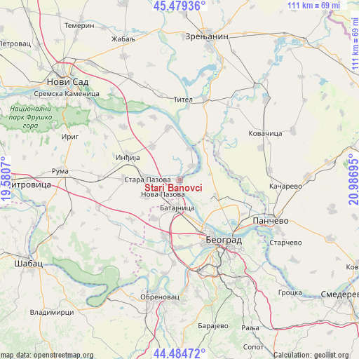
Stari Banovci GPS coordinates[2]
44° 59' 3.12" North, 20° 17' 1.752" East
| Map corner | latitude | longitude |
|---|---|---|
| Upper-left | 45.47936°, | 19.5807° |
| Center: | 44.9842°, | 20.28382° |
| Lower-right: | 44.48472°, | 20.98695° |
| Map W x H: | 110.6×110.6 km | = 68.7×68.7mi |
| max Lat: | 46.1° ⇑43.1% North |
| Stari Banovci: | 44.9842° |
| min Lat: | ⇓56.9% South 42.25846° |
| min Long | Stari Banovci | max Long |
| 18.9276° | 20.28382° | 22.77556° |
| W 45.8%⇐ | ⇒54.2% E |
Elevation
Elevation of Stari Banovci is 77 m = 253 ft, and this is 99.4 m = 326 ft below average elevation for this country.
| Max E: |
1421 m = 4662 ft | 84.8% |
| Avg. | 176.4 m = 579 ft | |
| Stari Banovci | 77 m = 253 ft | |
Min E: |
49 m = 161 ft | 15.2% |
See also: Serbia elevation on elevation.city.
Geographical zone
Stari Banovci is located in North temperate zone (between Tropic of Cancer and the Arctic Circle). Distance of this Northern Tropic circle is 2395.9 km =1488.7 mi to South.| Distance of | km | miles | from Stari Banovci |
|---|---|---|---|
| North Pole | 5005.3 | 3110.1 | to North |
| Arctic Circle | 2399.4 | 1490.9 | to North |
| Tropic Cancer | 2395.9 | 1488.7 | to South |
| Equator | 5001.8 | 3108 | to South |


Nearby cities:
15 places around Stari Banovci: (largest is in red/bold)
• Baranda
16.7 km =10.4 mi,  48°
48°
• Belegiš
5.5 km =3.4 mi,  44°
44°
• Golubinci
17.3 km =10.7 mi,  270°
270°
• Inđija
17.4 km =10.8 mi,  294°
294°
• Nova Pazova
6.8 km =4.2 mi,  228°
228°
• Novi Banovci
3 km =1.9 mi,  184°
184°
• Novi Karlovci
13.1 km =8.1 mi,  321°
321°
• Novi Slankamen
16.1 km =10 mi,  347°
347°
• Opovo
13.8 km =8.6 mi,  56°
56°
• Sefkerin
15.8 km =9.8 mi,  81°
81°
• Stara Pazova
9.7 km =6 mi, 270°
• Surduk
10.2 km =6.3 mi,  18°
18°
• Ugrinovci
14.2 km =8.8 mi,  212°
212°
• Vojka
11.6 km =7.2 mi,  243°
243°
• Čenta
16.1 km =10 mi,  31°
31°
Sources, notices
• [Note1] Compared only with cities in Serbia existing in our database
• [Src1] Map data: © OpenStreetMap contributors (CC-BY-SA)
• [Src2] Other city data from geonames.org with taken over terms of usage.
• [Src3] Geographical zone / Annual Mean Temperature by Robert A. Rohde @ Wikipedia
