Kruševac geodata
Kruševac (Central Serbia) is a seat of a second-order administrative division; located in Serbia in Europe/Belgrade (GMT+2) time zone. With population of 75,256 people, there are 12 cities with bigger population in this country. Compared to other cities in Serbia, 86.2% of cities are located further ↑North; 82.1% of cities are located further ←West and 70.5% of cities have lower elevation than Kruševac. Note1


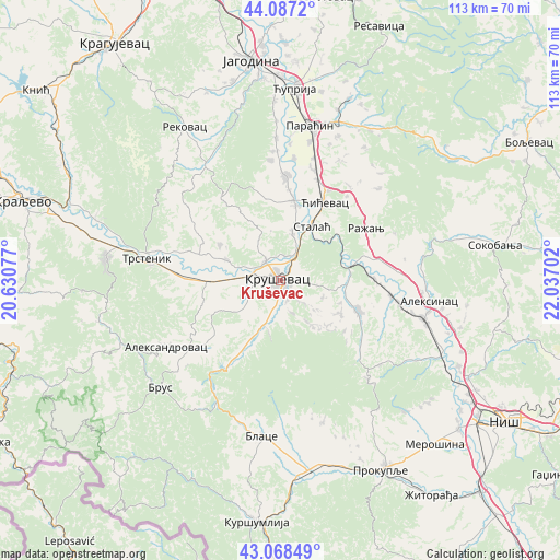
Kruševac GPS coordinates[2]
43° 34' 48" North, 21° 20' 2.004" East
| Map corner | latitude | longitude |
|---|---|---|
| Upper-left | 44.0872°, | 20.63077° |
| Center: | 43.58°, | 21.33389° |
| Lower-right: | 43.06849°, | 22.03702° |
| Map W x H: | 113.3×113.3 km | = 70.4×70.4mi |
| max Lat: | 46.1° ⇑86.2% North |
| Kruševac: | 43.58° |
| min Lat: | ⇓13.8% South 42.25846° |
| min Long | Kruševac | max Long |
| 18.9276° | 21.33389° | 22.77556° |
| W 82.1%⇐ | ⇒17.9% E |
Elevation
Elevation of Kruševac is 162 m = 531 ft, and this is 14.4 m = 47 ft below average elevation for this country.
| Max E: |
1421 m = 4662 ft | 29.5% |
| Avg. | 176.4 m = 579 ft | |
| Kruševac | 162 m = 531 ft | |
Min E: |
49 m = 161 ft | 70.5% |
See also: Kruševac elevation on elevation.city.
Geographical zone
Kruševac is located in North temperate zone (between Tropic of Cancer and the Arctic Circle). Distance of this Northern Tropic circle is 2239.7 km =1391.7 mi to South.| Distance of | km | miles | from Kruševac |
|---|---|---|---|
| North Pole | 5161.4 | 3207.1 | to North |
| Arctic Circle | 2555.5 | 1587.9 | to North |
| Tropic Cancer | 2239.7 | 1391.7 | to South |
| Equator | 4845.6 | 3010.9 | to South |


Nearby cities:
15 places around Kruševac: (largest is in red/bold)
• Aleksandrovac
26.4 km =16.4 mi,  239°
239°
• Aleksinac
30.4 km =18.9 mi,  98°
98°
• Bace
40.1 km =24.9 mi,  178°
178°
• Beloljin
38.3 km =23.8 mi,  172°
172°
• Blace
31.9 km =19.8 mi,  186°
186°
• Paraćin
31.8 km =19.8 mi,  10°
10°
• Ražanj
20.2 km =12.6 mi,  59°
59°
• Rekovac
36.9 km =22.9 mi,  328°
328°
• Suvi Do
35.8 km =22.2 mi, 180°
• Trstenik
27 km =16.8 mi,  278°
278°
• Tulare
39.3 km =24.4 mi, 174°
• Varvarin
16.2 km =10.1 mi, 8°
• Vrnjačka Banja
35.6 km =22.1 mi, 278°
• Ćićevac
17.7 km =11 mi,  29°
29°
• Ćuprija
38.7 km =24 mi,  4°
4°
Sources, notices
• [Note1] Compared only with cities in Serbia existing in our database
• [Src1] Map data: © OpenStreetMap contributors (CC-BY-SA)
• [Src2] Other city data from geonames.org with taken over terms of usage.
• [Src3] Geographical zone / Annual Mean Temperature by Robert A. Rohde @ Wikipedia
