Bace geodata
Bace (Central Serbia) is a populated place; located in Serbia in Europe/Belgrade (GMT+2) time zone. With population of 509 people, there are 357 cities with bigger population in this country. Compared to other cities in Serbia, 90.7% of cities are located further ↑North; 82.5% of cities are located further ←West and 85.7% of cities have lower elevation than Bace. Note1


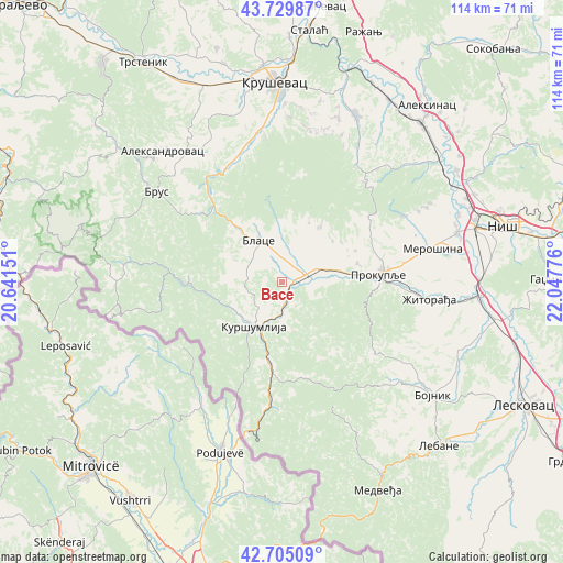
Bace GPS coordinates[2]
43° 13' 10.668" North, 21° 20' 40.668" East
| Map corner | latitude | longitude |
|---|---|---|
| Upper-left | 43.72987°, | 20.64151° |
| Center: | 43.21963°, | 21.34463° |
| Lower-right: | 42.70509°, | 22.04776° |
| Map W x H: | 113.9×113.9 km | = 70.8×70.8mi |
| max Lat: | 46.1° ⇑90.7% North |
| Bace: | 43.21963° |
| min Lat: | ⇓9.3% South 42.25846° |
| min Long | Bace | max Long |
| 18.9276° | 21.34463° | 22.77556° |
| W 82.5%⇐ | ⇒17.5% E |
Elevation
Elevation of Bace is 315 m = 1033 ft, and this is 138.6 m = 455 ft above average elevation for this country.
| Max E: |
1421 m = 4662 ft | 14.3% |
| Bace | 315 m 1033 ft | |
| Avg. | 176.4 m = 579 ft | |
Min E: |
49 m = 161 ft | 85.7% |
See also: Serbia elevation on elevation.city.
Geographical zone
Bace is located in North temperate zone (between Tropic of Cancer and the Arctic Circle). Distance of this Northern Tropic circle is 2199.7 km =1366.8 mi to South.| Distance of | km | miles | from Bace |
|---|---|---|---|
| North Pole | 5201.5 | 3232.1 | to North |
| Arctic Circle | 2595.6 | 1612.8 | to North |
| Tropic Cancer | 2199.7 | 1366.8 | to South |
| Equator | 4805.6 | 2986.1 | to South |


Nearby cities:
15 places around Bace: (largest is in red/bold)
• Aleksandrovac
35.6 km =22.1 mi,  318°
318°
• Beloljin
4.7 km =2.9 mi,  63°
63°
• Blace
9.7 km =6 mi,  330°
330°
• Bojnik
38.3 km =23.8 mi,  127°
127°
• Doljevac
39.6 km =24.6 mi,  93°
93°
• Donja Konjuša
5.6 km =3.5 mi, 86°
• Kruševac
40.1 km =24.9 mi,  358°
358°
• Kuršumlija
10.7 km =6.6 mi,  212°
212°
• Lebane
45.8 km =28.5 mi,  135°
135°
• Merošina
31.3 km =19.4 mi,  76°
76°
• Prokuplje
19.8 km =12.3 mi, 85°
• Suvi Do
4.4 km =2.7 mi,  347°
347°
• Tulare
3 km =1.9 mi,  71°
71°
• Žitni Potok
23.6 km =14.7 mi, 127°
• Žitorađa
30 km =18.6 mi,  96°
96°
Sources, notices
• [Note1] Compared only with cities in Serbia existing in our database
• [Src1] Map data: © OpenStreetMap contributors (CC-BY-SA)
• [Src2] Other city data from geonames.org with taken over terms of usage.
• [Src3] Geographical zone / Annual Mean Temperature by Robert A. Rohde @ Wikipedia
