Tiszahegyes geodata
Tiszahegyes (Vojvodina) is a populated place; located in Serbia in Europe/Belgrade (GMT+2) time zone. With population of 2,338 people, there are 190 cities with bigger population in this country. Compared to other cities in Serbia, 95% of cities are located further ↓South; 51.7% of cities are located further →East and 84.8% of cities have higher elevation than Tiszahegyes. Note1


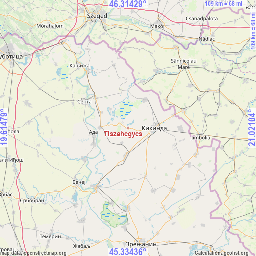
Tiszahegyes GPS coordinates[2]
45° 49' 35.328" North, 20° 19' 4.476" East
| Map corner | latitude | longitude |
|---|---|---|
| Upper-left | 46.31429°, | 19.61479° |
| Center: | 45.82648°, | 20.31791° |
| Lower-right: | 45.33436°, | 21.02104° |
| Map W x H: | 109×109 km | = 67.7×67.7mi |
| max Lat: | 46.1° ⇑5% North |
| Tiszahegyes: | 45.82648° |
| min Lat: | ⇓95% South 42.25846° |
| min Long | Tiszahegyes | max Long |
| 18.9276° | 20.31791° | 22.77556° |
| W 48.3%⇐ | ⇒51.7% E |
Elevation
Elevation of Tiszahegyes is 77 m = 253 ft, and this is 99.4 m = 326 ft below average elevation for this country.
| Max E: |
1421 m = 4662 ft | 84.8% |
| Avg. | 176.4 m = 579 ft | |
| Tiszahegyes | 77 m = 253 ft | |
Min E: |
49 m = 161 ft | 15.2% |
See also: Serbia elevation on elevation.city.
Geographical zone
Tiszahegyes is located in North temperate zone (between Tropic of Cancer and the Arctic Circle). Distance of this North polar circle is 2305.7 km =1432.7 mi to North.| Distance of | km | miles | from Tiszahegyes |
|---|---|---|---|
| North Pole | 4911.6 | 3051.9 | to North |
| Arctic Circle | 2305.7 | 1432.7 | to North |
| Tropic Cancer | 2489.5 | 1546.9 | to South |
| Equator | 5095.4 | 3166.1 | to South |


Nearby cities:
15 places around Tiszahegyes: (largest is in red/bold)
• Ada
15.1 km =9.4 mi,  259°
259°
• Banatska Topola
20.6 km =12.8 mi,  146°
146°
• Bočar
6.8 km =4.2 mi,  202°
202°
• Crna Bara
16.6 km =10.3 mi,  348°
348°
• Jazovo
11 km =6.8 mi,  317°
317°
• Kikinda
11.4 km =7.1 mi,  88°
88°
• Mokrin
14 km =8.7 mi,  31°
31°
• Mol
15.9 km =9.9 mi,  244°
244°
• Nakovo
20 km =12.4 mi,  74°
74°
• Novo Miloševo
12 km =7.5 mi,  185°
185°
• Ostojićevo
13.6 km =8.5 mi,  300°
300°
• Padej
12 km =7.5 mi,  270°
270°
• Sajan
3.5 km =2.2 mi, 299°
• Vrbica
19.9 km =12.4 mi,  358°
358°
• Čoka
18.7 km =11.6 mi,  313°
313°
Sources, notices
• [Note1] Compared only with cities in Serbia existing in our database
• [Src1] Map data: © OpenStreetMap contributors (CC-BY-SA)
• [Src2] Other city data from geonames.org with taken over terms of usage.
• [Src3] Geographical zone / Annual Mean Temperature by Robert A. Rohde @ Wikipedia
