Vrbica geodata
Vrbica (Vojvodina) is a populated place; located in Serbia in Europe/Belgrade (GMT+2) time zone. With population of 654 people, there are 344 cities with bigger population in this country. Compared to other cities in Serbia, 99.3% of cities are located further ↓South; 52.2% of cities are located further →East and 94.6% of cities have higher elevation than Vrbica. Note1


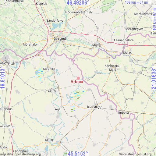
Vrbica GPS coordinates[2]
46° 0' 21.024" North, 20° 18' 47.7" East
| Map corner | latitude | longitude |
|---|---|---|
| Upper-left | 46.49206°, | 19.61013° |
| Center: | 46.00584°, | 20.31325° |
| Lower-right: | 45.5153°, | 21.01638° |
| Map W x H: | 108.6×108.6 km | = 67.5×67.5mi |
| max Lat: | 46.1° ⇑0.7% North |
| Vrbica: | 46.00584° |
| min Lat: | ⇓99.3% South 42.25846° |
| min Long | Vrbica | max Long |
| 18.9276° | 20.31325° | 22.77556° |
| W 47.8%⇐ | ⇒52.2% E |
Elevation
Elevation of Vrbica is 75 m = 246 ft, and this is 101.4 m = 333 ft below average elevation for this country.
| Max E: |
1421 m = 4662 ft | 94.6% |
| Avg. | 176.4 m = 579 ft | |
| Vrbica | 75 m = 246 ft | |
Min E: |
49 m = 161 ft | 5.4% |
See also: Serbia elevation on elevation.city.
Geographical zone
Vrbica is located in North temperate zone (between Tropic of Cancer and the Arctic Circle). Distance of this North polar circle is 2285.8 km =1420.3 mi to North.| Distance of | km | miles | from Vrbica |
|---|---|---|---|
| North Pole | 4891.7 | 3039.6 | to North |
| Arctic Circle | 2285.8 | 1420.3 | to North |
| Tropic Cancer | 2509.5 | 1559.3 | to South |
| Equator | 5115.4 | 3178.6 | to South |


Nearby cities:
15 places around Vrbica: (largest is in red/bold)
• Adorjan
21.1 km =13.1 mi,  269°
269°
• Crna Bara
4.6 km =2.9 mi,  218°
218°
• Jazovo
13.9 km =8.6 mi,  210°
210°
• Kanjiža
21.4 km =13.3 mi,  288°
288°
• Kikinda
22.8 km =14.2 mi,  149°
149°
• Mokrin
11.1 km =6.9 mi,  136°
136°
• Nakovo
24.4 km =15.2 mi,  126°
126°
• Novi Kneževac
17.2 km =10.7 mi, 286°
• Ostojićevo
17.3 km =10.7 mi, 221°
• Padej
23 km =14.3 mi, 210°
• Sajan
18.4 km =11.4 mi,  188°
188°
• Sanad
16.2 km =10.1 mi,  258°
258°
• Senta
20.2 km =12.6 mi,  244°
244°
• Tiszahegyes
19.9 km =12.4 mi,  178°
178°
• Čoka
14.9 km =9.3 mi, 241°
Sources, notices
• [Note1] Compared only with cities in Serbia existing in our database
• [Src1] Map data: © OpenStreetMap contributors (CC-BY-SA)
• [Src2] Other city data from geonames.org with taken over terms of usage.
• [Src3] Geographical zone / Annual Mean Temperature by Robert A. Rohde @ Wikipedia
