Bočar geodata
Bočar (Vojvodina) is a populated place; located in Serbia in Europe/Belgrade (GMT+2) time zone. With population of 2,095 people, there are 207 cities with bigger population in this country. Compared to other cities in Serbia, 93.7% of cities are located further ↓South; 54% of cities are located further →East and 84.8% of cities have higher elevation than Bočar. Note1


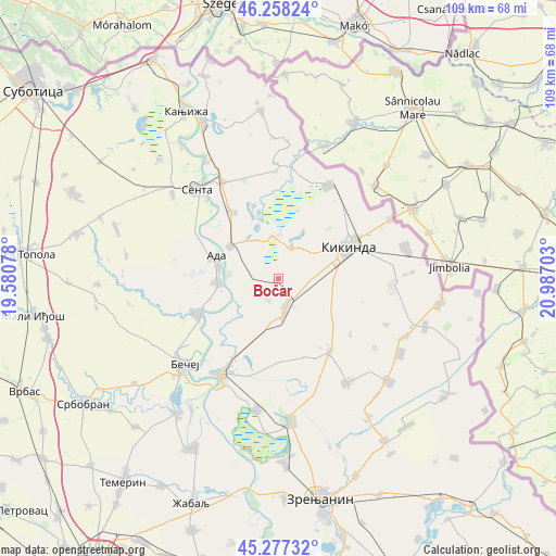
Bočar GPS coordinates[2]
45° 46' 11.784" North, 20° 17' 2.04" East
| Map corner | latitude | longitude |
|---|---|---|
| Upper-left | 46.25824°, | 19.58078° |
| Center: | 45.76994°, | 20.2839° |
| Lower-right: | 45.27732°, | 20.98703° |
| Map W x H: | 109.1×109.1 km | = 67.8×67.8mi |
| max Lat: | 46.1° ⇑6.3% North |
| Bočar: | 45.76994° |
| min Lat: | ⇓93.7% South 42.25846° |
| min Long | Bočar | max Long |
| 18.9276° | 20.2839° | 22.77556° |
| W 46%⇐ | ⇒54% E |
Elevation
Elevation of Bočar is 77 m = 253 ft, and this is 99.4 m = 326 ft below average elevation for this country.
| Max E: |
1421 m = 4662 ft | 84.8% |
| Avg. | 176.4 m = 579 ft | |
| Bočar | 77 m = 253 ft | |
Min E: |
49 m = 161 ft | 15.2% |
See also: Serbia elevation on elevation.city.
Geographical zone
Bočar is located in North temperate zone (between Tropic of Cancer and the Arctic Circle). Distance of this North polar circle is 2312 km =1436.6 mi to North.| Distance of | km | miles | from Bočar |
|---|---|---|---|
| North Pole | 4917.9 | 3055.8 | to North |
| Arctic Circle | 2312 | 1436.6 | to North |
| Tropic Cancer | 2483.2 | 1543 | to South |
| Equator | 5089.1 | 3162.2 | to South |


Nearby cities:
15 places around Bočar: (largest is in red/bold)
• Ada
12.8 km =8 mi,  286°
286°
• Banatska Topola
17.8 km =11.1 mi,  127°
127°
• Bačko Petrovo Selo
17.4 km =10.8 mi,  246°
246°
• Bašaid
17.6 km =10.9 mi,  144°
144°
• Jazovo
15.1 km =9.4 mi,  341°
341°
• Kikinda
15.6 km =9.7 mi,  64°
64°
• Mokrin
20.7 km =12.9 mi,  28°
28°
• Mol
11.7 km =7.3 mi,  267°
267°
• Novo Miloševo
5.9 km =3.7 mi,  164°
164°
• Ostojićevo
16 km =9.9 mi,  325°
325°
• Padej
11.4 km =7.1 mi,  304°
304°
• Rusko Selo
22.3 km =13.9 mi,  92°
92°
• Sajan
8.1 km =5 mi,  356°
356°
• Tiszahegyes
6.8 km =4.2 mi,  22°
22°
• Čoka
22.1 km =13.7 mi, 330°
Sources, notices
• [Note1] Compared only with cities in Serbia existing in our database
• [Src1] Map data: © OpenStreetMap contributors (CC-BY-SA)
• [Src2] Other city data from geonames.org with taken over terms of usage.
• [Src3] Geographical zone / Annual Mean Temperature by Robert A. Rohde @ Wikipedia
