Zolotinka geodata
Zolotinka (Sakha) is a populated place; located in Russia in Asia/Yakutsk (GMT+9) time zone. With population of 548 people, there are 4935 cities with bigger population in this country. Compared to other cities in Russia, 69.1% of cities are located further ↓South; 93.4% of cities are located further ←West and 98% of cities have lower elevation than Zolotinka. Note1


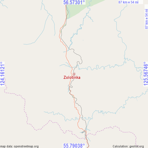
Zolotinka GPS coordinates[2]
56° 11' 1.284" North, 124° 51' 51.588" East
| Map corner | latitude | longitude |
|---|---|---|
| Upper-left | 56.57301°, | 124.16121° |
| Center: | 56.18369°, | 124.86433° |
| Lower-right: | 55.79038°, | 125.56746° |
| Map W x H: | 87×87 km | = 54.1×54.1mi |
| max Lat: | 73.50819° ⇑30.9% North |
| Zolotinka: | 56.18369° |
| min Lat: | ⇓69.1% South 41.28413° |
| min Long | Zolotinka | max Long |
| -179.12198° | 124.86433° | 179.35046° |
| W 93.4%⇐ | ⇒6.6% E |
Elevation
Elevation of Zolotinka is 876 m = 2874 ft, and this is 673.4 m = 2209 ft above average elevation for this country.
| Max E: |
2518 m = 8261 ft | 2% |
| Zolotinka | 876 m 2874 ft | |
| Avg. | 202.6 m = 665 ft | |
Min E: |
-28 m = -92 ft | 98% |
See also: Russia elevation on elevation.city.
Geographical zone
Zolotinka is located in North temperate zone (between Tropic of Cancer and the Arctic Circle). Distance of this North polar circle is 1154.1 km =717.1 mi to North.| Distance of | km | miles | from Zolotinka |
|---|---|---|---|
| North Pole | 3760 | 2336.4 | to North |
| Arctic Circle | 1154.1 | 717.1 | to North |
| Tropic Cancer | 3641.1 | 2262.5 | to South |
| Equator | 6247 | 3881.7 | to South |


Nearby cities:
15 places around Zolotinka: (largest is in red/bold)
• Aldan
271.7 km =168.8 mi,  6°
6°
• Berkakit
43.8 km =27.2 mi,  352°
352°
• Chul’man
73.8 km =45.9 mi,  2°
2°
• Khani
254.6 km =158.2 mi,  291°
291°
• Lebedinyy
259 km =160.9 mi, 8°
• Leninskiy
267.7 km =166.3 mi, 7°
• Neryungri
55.4 km =34.4 mi, 345°
• Never
249.2 km =154.8 mi,  190°
190°
• Serebryanyy Bor
54.2 km =33.7 mi,  358°
358°
• Skovorodino
251.5 km =156.3 mi, 193°
• Solovjevsk
218.6 km =135.8 mi, 187°
• Takhtamygda
244 km =151.6 mi,  199°
199°
• Taldan
277.3 km =172.3 mi,  180°
180°
• Tynda
114.6 km =71.2 mi, 184°
• Urusha
268.2 km =166.7 mi,  207°
207°
Sources, notices
• [Note1] Compared only with cities in Russia existing in our database
• [Src1] Map data: © OpenStreetMap contributors (CC-BY-SA)
• [Src2] Other city data from geonames.org with taken over terms of usage.
• [Src3] Geographical zone / Annual Mean Temperature by Robert A. Rohde @ Wikipedia
