Serebryanyy Bor geodata
Serebryanyy Bor (Sakha) is a populated place; located in Russia in Asia/Yakutsk (GMT+9) time zone. With population of 4,302 people, there are 2954 cities with bigger population in this country. Compared to other cities in Russia, 74.1% of cities are located further ↓South; 93.4% of cities are located further ←West and 97.8% of cities have lower elevation than Serebryanyy Bor. Note1


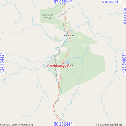
Serebryanyy Bor GPS coordinates[2]
56° 40' 14.736" North, 124° 50' 15.144" East
| Map corner | latitude | longitude |
|---|---|---|
| Upper-left | 57.05511°, | 124.13442° |
| Center: | 56.67076°, | 124.83754° |
| Lower-right: | 56.28244°, | 125.54067° |
| Map W x H: | 85.9×85.9 km | = 53.4×53.4mi |
| max Lat: | 73.50819° ⇑25.9% North |
| Serebryanyy Bor: | 56.67076° |
| min Lat: | ⇓74.1% South 41.28413° |
| min Long | Serebryanyy Bor | max Long |
| -179.12198° | 124.83754° | 179.35046° |
| W 93.4%⇐ | ⇒6.6% E |
Elevation
Elevation of Serebryanyy Bor is 856 m = 2808 ft, and this is 653.4 m = 2144 ft above average elevation for this country.
| Max E: |
2518 m = 8261 ft | 2.2% |
| Serebryanyy Bor | 856 m 2808 ft | |
| Avg. | 202.6 m = 665 ft | |
Min E: |
-28 m = -92 ft | 97.8% |
See also: Russia elevation on elevation.city.
Geographical zone
Serebryanyy Bor is located in North temperate zone (between Tropic of Cancer and the Arctic Circle). Distance of this North polar circle is 1100 km =683.5 mi to North.| Distance of | km | miles | from Serebryanyy Bor |
|---|---|---|---|
| North Pole | 3705.9 | 2302.7 | to North |
| Arctic Circle | 1100 | 683.5 | to North |
| Tropic Cancer | 3695.3 | 2296.2 | to South |
| Equator | 6301.2 | 3915.4 | to South |


Nearby cities:
15 places around Serebryanyy Bor: (largest is in red/bold)
• Aldan
218.2 km =135.6 mi,  8°
8°
• Berkakit
11.3 km =7 mi,  199°
199°
• Chul’man
20.1 km =12.5 mi, 12°
• Khani
236.6 km =147 mi,  279°
279°
• Lebedinyy
205.9 km =127.9 mi, 10°
• Leninskiy
214.3 km =133.2 mi, 9°
• Neryungri
12.2 km =7.6 mi,  267°
267°
• Never
302.3 km =187.8 mi,  188°
188°
• Nizhniy Kuranakh
242.8 km =150.9 mi, 9°
• Skovorodino
304 km =188.9 mi, 190°
• Solovjevsk
272.2 km =169.1 mi, 185°
• Takhtamygda
295.1 km =183.4 mi, 195°
• Tommot
268.4 km =166.8 mi,  18°
18°
• Tynda
168.6 km =104.8 mi,  182°
182°
• Zolotinka
54.2 km =33.7 mi, 178°
Sources, notices
• [Note1] Compared only with cities in Russia existing in our database
• [Src1] Map data: © OpenStreetMap contributors (CC-BY-SA)
• [Src2] Other city data from geonames.org with taken over terms of usage.
• [Src3] Geographical zone / Annual Mean Temperature by Robert A. Rohde @ Wikipedia
