Shelopugino geodata
Shelopugino (Transbaikal Territory) is a populated place; located in Russia in Asia/Chita (GMT+9) time zone. With population of 3,416 people, there are 3460 cities with bigger population in this country. Compared to other cities in Russia, 71.6% of cities are located further ↑North; 92.7% of cities are located further ←West and 95.8% of cities have lower elevation than Shelopugino. Note1


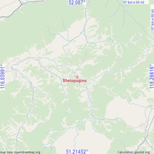
Shelopugino GPS coordinates[2]
51° 39' 10.296" North, 117° 33' 46.908" East
| Map corner | latitude | longitude |
|---|---|---|
| Upper-left | 52.087°, | 116.85991° |
| Center: | 51.65286°, | 117.56303° |
| Lower-right: | 51.21452°, | 118.26616° |
| Map W x H: | 97×97 km | = 60.3×60.3mi |
| max Lat: | 73.50819° ⇑71.6% North |
| Shelopugino: | 51.65286° |
| min Lat: | ⇓28.4% South 41.28413° |
| min Long | Shelopugino | max Long |
| -179.12198° | 117.56303° | 179.35046° |
| W 92.7%⇐ | ⇒7.3% E |
Elevation
Elevation of Shelopugino is 684 m = 2244 ft, and this is 481.4 m = 1579 ft above average elevation for this country.
| Max E: |
2518 m = 8261 ft | 4.2% |
| Shelopugino | 684 m 2244 ft | |
| Avg. | 202.6 m = 665 ft | |
Min E: |
-28 m = -92 ft | 95.8% |
See also: Russia elevation on elevation.city.
Geographical zone
Shelopugino is located in North temperate zone (between Tropic of Cancer and the Arctic Circle). Distance of this North polar circle is 1657.9 km =1030.2 mi to North.| Distance of | km | miles | from Shelopugino |
|---|---|---|---|
| North Pole | 4263.8 | 2649.4 | to North |
| Arctic Circle | 1657.9 | 1030.2 | to North |
| Tropic Cancer | 3137.3 | 1949.4 | to South |
| Equator | 5743.3 | 3568.7 | to South |


Nearby cities:
15 places around Shelopugino: (largest is in red/bold)
• Aleksandrovskiy Zavod
85 km =52.8 mi,  162°
162°
• Arbagar
95.5 km =59.3 mi,  289°
289°
• Baley
64.6 km =40.1 mi,  262°
262°
• Chernyshevsk
103.6 km =64.4 mi,  338°
338°
• Gazimurskiy Zavod
55.1 km =34.2 mi,  101°
101°
• Kalanguy
101.4 km =63 mi,  225°
225°
• Kalga
123.2 km =76.6 mi,  131°
131°
• Kholbon
93.9 km =58.3 mi, 285°
• Kokuy
61.5 km =38.2 mi,  359°
359°
• Nerchinsk
76.7 km =47.7 mi,  298°
298°
• Priiskovyy
71.1 km =44.2 mi, 296°
• Shilka
107.6 km =66.9 mi,  281°
281°
• Sretensk
66.9 km =41.6 mi,  8°
8°
• Vershino-Shakhtaminskiy
45.2 km =28.1 mi,  150°
150°
• Zhireken
131.7 km =81.8 mi,  352°
352°
Sources, notices
• [Note1] Compared only with cities in Russia existing in our database
• [Src1] Map data: © OpenStreetMap contributors (CC-BY-SA)
• [Src2] Other city data from geonames.org with taken over terms of usage.
• [Src3] Geographical zone / Annual Mean Temperature by Robert A. Rohde @ Wikipedia
