Vershino-Shakhtaminskiy geodata
Vershino-Shakhtaminskiy (Transbaikal Territory) is a populated place; located in Russia in Asia/Chita (GMT+9) time zone. With population of 1,633 people, there are 4322 cities with bigger population in this country. Compared to other cities in Russia, 73.5% of cities are located further ↑North; 92.7% of cities are located further ←West and 98.6% of cities have lower elevation than Vershino-Shakhtaminskiy. Note1
Current local time in Vershino-Shakhtaminskiy:
12:02 AM, TuesdayDifference from your time zone: hours


Vershino-Shakhtaminskiy GPS coordinates[2]
51° 18' 0.864" North, 117° 53' 15.432" East
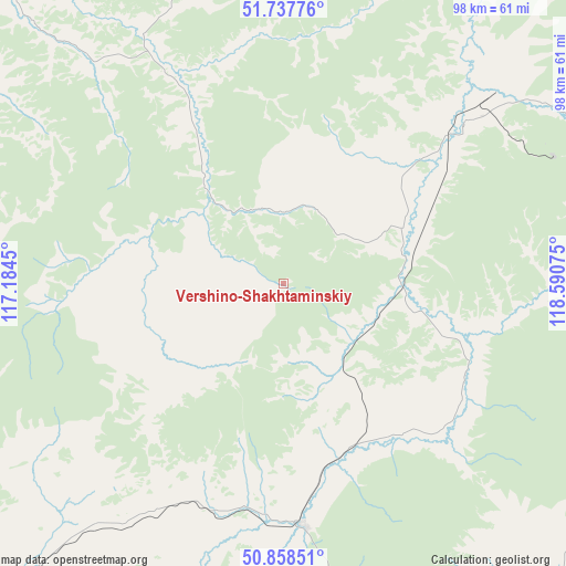
| Map corner | latitude | longitude |
|---|---|---|
| Upper-left | 51.73776°, | 117.1845° |
| Center: | 51.30024°, | 117.88762° |
| Lower-right: | 50.85851°, | 118.59075° |
| Map W x H: | 97.8×97.8 km | = 60.8×60.8mi |
| max Lat: | 73.50819° ⇑73.5% North |
| Vershino-Shakhtaminskiy: | 51.30024° |
| min Lat: | ⇓26.5% South 41.28413° |
| min Long | Vershino-Shakht | max Long |
| -179.12198° | 117.88762° | 179.35046° |
| W 92.7%⇐ | ⇒7.3% E |
Elevation
Elevation of Vershino-Shakhtaminskiy is 978 m = 3209 ft, and this is 775.4 m = 2544 ft above average elevation for this country.
| Max E: |
2518 m = 8261 ft | 1.4% |
| Vershino-Shakhtaminskiy | 978 m 3209 ft | |
| Avg. | 202.6 m = 665 ft | |
Min E: |
-28 m = -92 ft | 98.6% |
See also: Russia elevation on elevation.city.
Geographical zone
Vershino-Shakhtaminskiy is located in North temperate zone (between Tropic of Cancer and the Arctic Circle). Distance of this North polar circle is 1697.1 km =1054.5 mi to North.| Distance of | km | miles | from Vershino-Shakhtaminskiy |
|---|---|---|---|
| North Pole | 4303 | 2673.8 | to North |
| Arctic Circle | 1697.1 | 1054.5 | to North |
| Tropic Cancer | 3098.1 | 1925.1 | to South |
| Equator | 5704.1 | 3544.4 | to South |


Nearby cities:
15 places around Vershino-Shakhtaminskiy: (largest is in red/bold)
• Aleksandrovskiy Zavod
41.8 km =26 mi,  175°
175°
• Arbagar
133.2 km =82.8 mi,  301°
301°
• Baley
92.3 km =57.4 mi,  289°
289°
• Gazimurskiy Zavod
42.4 km =26.3 mi,  48°
48°
• Kadaya
106.4 km =66.1 mi,  112°
112°
• Kalanguy
100.7 km =62.6 mi,  251°
251°
• Kalga
82 km =51 mi,  120°
120°
• Kholbon
130.4 km =81 mi, 299°
• Klichka
95.3 km =59.2 mi, 175°
• Kokuy
103.3 km =64.2 mi,  347°
347°
• Nerchinsk
117.8 km =73.2 mi,  310°
310°
• Nerchinskiy Zavod
120.1 km =74.6 mi,  89°
89°
• Priiskovyy
111.6 km =69.3 mi, 309°
• Shelopugino
45.2 km =28.1 mi,  330°
330°
• Sretensk
106.1 km =65.9 mi, 353°
Sources, notices
• [Note1] Compared only with cities in Russia existing in our database
• [Src1] Map data: © OpenStreetMap contributors (CC-BY-SA)
• [Src2] Other city data from geonames.org with taken over terms of usage.
• [Src3] Geographical zone / Annual Mean Temperature by Robert A. Rohde @ Wikipedia
