Tataurovo geodata
Tataurovo (Buryatiya Republic) is a populated place; located in Russia in Asia/Irkutsk (GMT+8) time zone. With population of 2,381 people, there are 4006 cities with bigger population in this country. Compared to other cities in Russia, 68.4% of cities are located further ↑North; 90.4% of cities are located further ←West and 91.5% of cities have lower elevation than Tataurovo. Note1


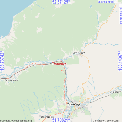
Tataurovo GPS coordinates[2]
52° 8' 30.552" North, 107° 26' 25.944" East
| Map corner | latitude | longitude |
|---|---|---|
| Upper-left | 52.57125°, | 106.73742° |
| Center: | 52.14182°, | 107.44054° |
| Lower-right: | 51.70821°, | 108.14367° |
| Map W x H: | 96×96 km | = 59.7×59.7mi |
| max Lat: | 73.50819° ⇑68.4% North |
| Tataurovo: | 52.14182° |
| min Lat: | ⇓31.6% South 41.28413° |
| min Long | Tataurovo | max Long |
| -179.12198° | 107.44054° | 179.35046° |
| W 90.4%⇐ | ⇒9.6% E |
Elevation
Elevation of Tataurovo is 489 m = 1604 ft, and this is 286.4 m = 940 ft above average elevation for this country.
| Max E: |
2518 m = 8261 ft | 8.5% |
| Tataurovo | 489 m 1604 ft | |
| Avg. | 202.6 m = 665 ft | |
Min E: |
-28 m = -92 ft | 91.5% |
See also: Russia elevation on elevation.city.
Geographical zone
Tataurovo is located in North temperate zone (between Tropic of Cancer and the Arctic Circle). Distance of this North polar circle is 1603.5 km =996.4 mi to North.| Distance of | km | miles | from Tataurovo |
|---|---|---|---|
| North Pole | 4209.4 | 2615.6 | to North |
| Arctic Circle | 1603.5 | 996.4 | to North |
| Tropic Cancer | 3191.7 | 1983.2 | to South |
| Equator | 5797.6 | 3602.5 | to South |


Nearby cities:
15 places around Tataurovo: (largest is in red/bold)
• Il’inka
11.8 km =7.3 mi,  257°
257°
• Ivolginsk
45 km =28 mi,  193°
193°
• Kabansk
54.8 km =34.1 mi, 259°
• Nikolayevskiy
59.5 km =37 mi,  155°
155°
• Nizhniy Sayantuy
45.2 km =28.1 mi,  173°
173°
• Novaya Bryan’
73.9 km =45.9 mi,  129°
129°
• Onokhoy
49 km =30.4 mi,  118°
118°
• Sokol
38 km =23.6 mi,  179°
179°
• Sotnikovo
28.8 km =17.9 mi, 174°
• Tarbagatay
73.6 km =45.7 mi, 184°
• Turuntayevo
15.5 km =9.6 mi,  64°
64°
• Ulan-Ude
36.8 km =22.9 mi, 162°
• Verkhnyaya Ivolga
46.5 km =28.9 mi,  201°
201°
• Zaigrayevo
66.1 km =41.1 mi, 121°
• Zarechnyy
33 km =20.5 mi, 170°
Sources, notices
• [Note1] Compared only with cities in Russia existing in our database
• [Src1] Map data: © OpenStreetMap contributors (CC-BY-SA)
• [Src2] Other city data from geonames.org with taken over terms of usage.
• [Src3] Geographical zone / Annual Mean Temperature by Robert A. Rohde @ Wikipedia
