Kabansk geodata
Kabansk (Buryatiya Republic) is a populated place; located in Russia in Asia/Irkutsk (GMT+8) time zone. With population of 6,257 people, there are 2190 cities with bigger population in this country. Compared to other cities in Russia, 68.9% of cities are located further ↑North; 90.2% of cities are located further ←West and 90.6% of cities have lower elevation than Kabansk. Note1


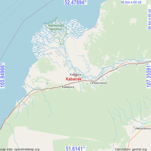
Kabansk GPS coordinates[2]
52° 2' 54.996" North, 106° 39' 10.008" East
| Map corner | latitude | longitude |
|---|---|---|
| Upper-left | 52.47894°, | 105.94966° |
| Center: | 52.04861°, | 106.65278° |
| Lower-right: | 51.6141°, | 107.35591° |
| Map W x H: | 96.2×96.2 km | = 59.8×59.8mi |
| max Lat: | 73.50819° ⇑68.9% North |
| Kabansk: | 52.04861° |
| min Lat: | ⇓31.1% South 41.28413° |
| min Long | Kabansk | max Long |
| -179.12198° | 106.65278° | 179.35046° |
| W 90.2%⇐ | ⇒9.8% E |
Elevation
Elevation of Kabansk is 467 m = 1532 ft, and this is 264.4 m = 867 ft above average elevation for this country.
| Max E: |
2518 m = 8261 ft | 9.4% |
| Kabansk | 467 m 1532 ft | |
| Avg. | 202.6 m = 665 ft | |
Min E: |
-28 m = -92 ft | 90.6% |
See also: Russia elevation on elevation.city.
Geographical zone
Kabansk is located in North temperate zone (between Tropic of Cancer and the Arctic Circle). Distance of this North polar circle is 1613.9 km =1002.8 mi to North.| Distance of | km | miles | from Kabansk |
|---|---|---|---|
| North Pole | 4219.8 | 2622.1 | to North |
| Arctic Circle | 1613.9 | 1002.8 | to North |
| Tropic Cancer | 3181.3 | 1976.8 | to South |
| Equator | 5787.3 | 3596.1 | to South |


Nearby cities:
15 places around Kabansk: (largest is in red/bold)
• Babushkin
65.8 km =40.9 mi,  235°
235°
• Bugul’deyka
67.9 km =42.2 mi,  324°
324°
• Il’inka
43 km =26.7 mi,  79°
79°
• Istok
28.2 km =17.5 mi,  280°
280°
• Ivolginsk
54.6 km =33.9 mi,  127°
127°
• Nizhniy Sayantuy
68.4 km =42.5 mi,  120°
120°
• Posol’skoye
32.7 km =20.3 mi,  264°
264°
• Sokol
60.9 km =37.8 mi, 116°
• Sotnikovo
59.7 km =37.1 mi,  107°
107°
• Tarbagatay
79.7 km =49.5 mi,  142°
142°
• Tataurovo
54.8 km =34.1 mi, 79°
• Turuntayevo
69.8 km =43.4 mi, 75°
• Ulan-Ude
69.8 km =43.4 mi, 110°
• Verkhnyaya Ivolga
49.8 km =30.9 mi, 131°
• Zarechnyy
63.5 km =39.5 mi, 110°
Sources, notices
• [Note1] Compared only with cities in Russia existing in our database
• [Src1] Map data: © OpenStreetMap contributors (CC-BY-SA)
• [Src2] Other city data from geonames.org with taken over terms of usage.
• [Src3] Geographical zone / Annual Mean Temperature by Robert A. Rohde @ Wikipedia
