Pokrovsk geodata
Pokrovsk (Sakha) is a populated place; located in Russia in Asia/Yakutsk (GMT+9) time zone. With population of 9,763 people, there are 1545 cities with bigger population in this country. Compared to other cities in Russia, 93.9% of cities are located further ↓South; 94% of cities are located further ←West and 61.4% of cities have higher elevation than Pokrovsk. Note1


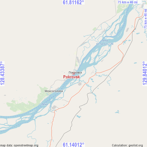
Pokrovsk GPS coordinates[2]
61° 28' 39.648" North, 129° 8' 13.164" East
| Map corner | latitude | longitude |
|---|---|---|
| Upper-left | 61.81162°, | 128.43387° |
| Center: | 61.47768°, | 129.13699° |
| Lower-right: | 61.14012°, | 129.84012° |
| Map W x H: | 74.7×74.7 km | = 46.4×46.4mi |
| max Lat: | 73.50819° ⇑6.1% North |
| Pokrovsk: | 61.47768° |
| min Lat: | ⇓93.9% South 41.28413° |
| min Long | Pokrovsk | max Long |
| -179.12198° | 129.13699° | 179.35046° |
| W 94%⇐ | ⇒6% E |
Elevation
Elevation of Pokrovsk is 121 m = 397 ft, and this is 81.6 m = 268 ft below average elevation for this country.
| Max E: |
2518 m = 8261 ft | 61.4% |
| Avg. | 202.6 m = 665 ft | |
| Pokrovsk | 121 m = 397 ft | |
Min E: |
-28 m = -92 ft | 38.6% |
See also: Russia elevation on elevation.city.
Geographical zone
Pokrovsk is located in North temperate zone (between Tropic of Cancer and the Arctic Circle). Distance of this North polar circle is 565.5 km =351.4 mi to North.| Distance of | km | miles | from Pokrovsk |
|---|---|---|---|
| North Pole | 3171.4 | 1970.6 | to North |
| Arctic Circle | 565.5 | 351.4 | to North |
| Tropic Cancer | 4229.8 | 2628.3 | to South |
| Equator | 6835.7 | 4247.5 | to South |


Nearby cities:
15 places around Pokrovsk: (largest is in red/bold)
• Amga
165.3 km =102.7 mi,  112°
112°
• Berdigestyakh
145.7 km =90.5 mi,  298°
298°
• Borogontsy
169.5 km =105.3 mi,  38°
38°
• Kangalassy
106.1 km =65.9 mi,  24°
24°
• Khatassy
54.4 km =33.8 mi,  28°
28°
• Magan
73 km =45.4 mi, 16°
• Markha
77.7 km =48.3 mi, 24°
• Mayya
67.1 km =41.7 mi,  64°
64°
• Mokhsogollokh
13.9 km =8.6 mi,  229°
229°
• Namtsy
140.8 km =87.5 mi,  11°
11°
• Nizhniy Bestyakh
67.6 km =42 mi, 37°
• Staraya Tabaga
46.3 km =28.8 mi, 34°
• Tabaga
48.6 km =30.2 mi, 30°
• Yakutsk
69.3 km =43.1 mi, 26°
• Zhatay
84.1 km =52.3 mi, 25°
Sources, notices
• [Note1] Compared only with cities in Russia existing in our database
• [Src1] Map data: © OpenStreetMap contributors (CC-BY-SA)
• [Src2] Other city data from geonames.org with taken over terms of usage.
• [Src3] Geographical zone / Annual Mean Temperature by Robert A. Rohde @ Wikipedia
