Berdigestyakh geodata
Berdigestyakh (Sakha) is a populated place; located in Russia in Asia/Yakutsk (GMT+9) time zone. With population of 5,948 people, there are 2272 cities with bigger population in this country. Compared to other cities in Russia, 95% of cities are located further ↓South; 93.6% of cities are located further ←West and 74% of cities have lower elevation than Berdigestyakh. Note1


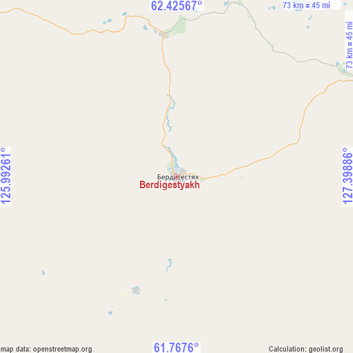
Berdigestyakh GPS coordinates[2]
62° 5' 54.312" North, 126° 41' 44.628" East
| Map corner | latitude | longitude |
|---|---|---|
| Upper-left | 62.42567°, | 125.99261° |
| Center: | 62.09842°, | 126.69573° |
| Lower-right: | 61.7676°, | 127.39886° |
| Map W x H: | 73.2×73.2 km | = 45.5×45.5mi |
| max Lat: | 73.50819° ⇑5% North |
| Berdigestyakh: | 62.09842° |
| min Lat: | ⇓95% South 41.28413° |
| min Long | Berdigestyakh | max Long |
| -179.12198° | 126.69573° | 179.35046° |
| W 93.6%⇐ | ⇒6.4% E |
Elevation
Elevation of Berdigestyakh is 212 m = 696 ft, and this is 9.4 m = 31 ft above average elevation for this country.
| Max E: |
2518 m = 8261 ft | 26% |
| Berdigestyakh | 212 m 696 ft | |
| Avg. | 202.6 m = 665 ft | |
Min E: |
-28 m = -92 ft | 74% |
See also: Russia elevation on elevation.city.
Geographical zone
Berdigestyakh is located in North temperate zone (between Tropic of Cancer and the Arctic Circle). Distance of this North polar circle is 496.5 km =308.5 mi to North.| Distance of | km | miles | from Berdigestyakh |
|---|---|---|---|
| North Pole | 3102.4 | 1927.7 | to North |
| Arctic Circle | 496.5 | 308.5 | to North |
| Tropic Cancer | 4298.8 | 2671.1 | to South |
| Equator | 6904.7 | 4290.4 | to South |


Nearby cities:
15 places around Berdigestyakh: (largest is in red/bold)
• Kangalassy
171.6 km =106.6 mi,  80°
80°
• Khatassy
154.8 km =96.2 mi,  97°
97°
• Magan
147.5 km =91.7 mi,  89°
89°
• Markha
158.6 km =98.5 mi, 89°
• Mayya
191.9 km =119.2 mi, 102°
• Mokhsogollokh
141.5 km =87.9 mi,  123°
123°
• Namtsy
167.9 km =104.3 mi,  65°
65°
• Nizhniy Bestyakh
168.4 km =104.6 mi, 95°
• Pokrovsk
145.7 km =90.5 mi, 118°
• Sangar
206.6 km =128.4 mi,  10°
10°
• Staraya Tabaga
156.6 km =97.3 mi, 101°
• Tabaga
154.1 km =95.8 mi, 100°
• Tommot
350 km =217.5 mi,  183°
183°
• Yakutsk
158.4 km =98.4 mi, 92°
• Zhatay
163 km =101.3 mi, 87°
Sources, notices
• [Note1] Compared only with cities in Russia existing in our database
• [Src1] Map data: © OpenStreetMap contributors (CC-BY-SA)
• [Src2] Other city data from geonames.org with taken over terms of usage.
• [Src3] Geographical zone / Annual Mean Temperature by Robert A. Rohde @ Wikipedia
