Mokhsogollokh geodata
Mokhsogollokh (Sakha) is a populated place; located in Russia in Asia/Yakutsk (GMT+9) time zone. With population of 6,947 people, there are 2015 cities with bigger population in this country. Compared to other cities in Russia, 93.9% of cities are located further ↓South; 94% of cities are located further ←West and 61.2% of cities have lower elevation than Mokhsogollokh. Note1


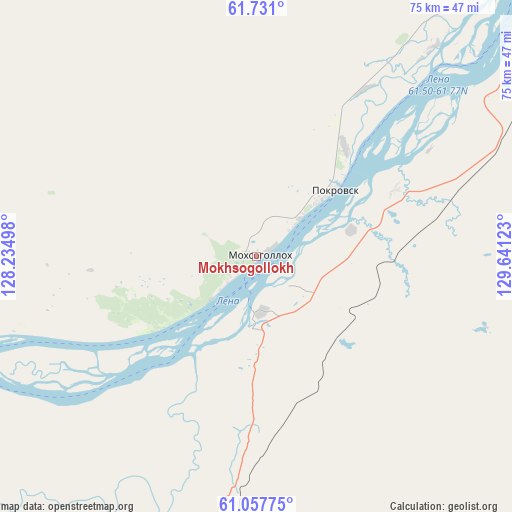
Mokhsogollokh GPS coordinates[2]
61° 23' 46.284" North, 128° 56' 17.16" East
| Map corner | latitude | longitude |
|---|---|---|
| Upper-left | 61.731°, | 128.23498° |
| Center: | 61.39619°, | 128.9381° |
| Lower-right: | 61.05775°, | 129.64123° |
| Map W x H: | 74.9×74.9 km | = 46.5×46.5mi |
| max Lat: | 73.50819° ⇑6.1% North |
| Mokhsogollokh: | 61.39619° |
| min Lat: | ⇓93.9% South 41.28413° |
| min Long | Mokhsogollokh | max Long |
| -179.12198° | 128.9381° | 179.35046° |
| W 94%⇐ | ⇒6% E |
Elevation
Elevation of Mokhsogollokh is 172 m = 564 ft, and this is 30.6 m = 100 ft below average elevation for this country.
| Max E: |
2518 m = 8261 ft | 38.8% |
| Avg. | 202.6 m = 665 ft | |
| Mokhsogollokh | 172 m = 564 ft | |
Min E: |
-28 m = -92 ft | 61.2% |
See also: Russia elevation on elevation.city.
Geographical zone
Mokhsogollokh is located in North temperate zone (between Tropic of Cancer and the Arctic Circle). Distance of this North polar circle is 574.6 km =357 mi to North.| Distance of | km | miles | from Mokhsogollokh |
|---|---|---|---|
| North Pole | 3180.4 | 1976.2 | to North |
| Arctic Circle | 574.6 | 357 | to North |
| Tropic Cancer | 4220.7 | 2622.6 | to South |
| Equator | 6826.6 | 4241.9 | to South |


Nearby cities:
15 places around Mokhsogollokh: (largest is in red/bold)
• Amga
172.2 km =107 mi,  108°
108°
• Berdigestyakh
141.5 km =87.9 mi,  303°
303°
• Borogontsy
183.1 km =113.8 mi,  39°
39°
• Kangalassy
118.7 km =73.8 mi,  26°
26°
• Khatassy
67.6 km =42 mi, 32°
• Magan
85 km =52.8 mi,  21°
21°
• Markha
90.4 km =56.2 mi, 27°
• Mayya
80.7 km =50.1 mi,  61°
61°
• Namtsy
152 km =94.4 mi,  14°
14°
• Nizhniy Bestyakh
81.2 km =50.5 mi, 39°
• Pokrovsk
13.9 km =8.6 mi,  49°
49°
• Staraya Tabaga
59.9 km =37.2 mi, 37°
• Tabaga
61.9 km =38.5 mi, 34°
• Yakutsk
82.4 km =51.2 mi, 30°
• Zhatay
96.9 km =60.2 mi, 28°
Sources, notices
• [Note1] Compared only with cities in Russia existing in our database
• [Src1] Map data: © OpenStreetMap contributors (CC-BY-SA)
• [Src2] Other city data from geonames.org with taken over terms of usage.
• [Src3] Geographical zone / Annual Mean Temperature by Robert A. Rohde @ Wikipedia
