Markha geodata
Markha (Sakha) is a populated place; located in Russia in Asia/Yakutsk (GMT+9) time zone. With population of 11,648 people, there are 1311 cities with bigger population in this country. Compared to other cities in Russia, 95.1% of cities are located further ↓South; 94.2% of cities are located further ←West and 71.5% of cities have higher elevation than Markha. Note1


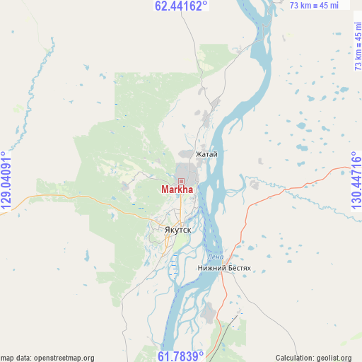
Markha GPS coordinates[2]
62° 6' 52.344" North, 129° 44' 38.508" East
| Map corner | latitude | longitude |
|---|---|---|
| Upper-left | 62.44162°, | 129.04091° |
| Center: | 62.11454°, | 129.74403° |
| Lower-right: | 61.7839°, | 130.44716° |
| Map W x H: | 73.1×73.1 km | = 45.4×45.4mi |
| max Lat: | 73.50819° ⇑4.9% North |
| Markha: | 62.11454° |
| min Lat: | ⇓95.1% South 41.28413° |
| min Long | Markha | max Long |
| -179.12198° | 129.74403° | 179.35046° |
| W 94.2%⇐ | ⇒5.8% E |
Elevation
Elevation of Markha is 99 m = 325 ft, and this is 103.6 m = 340 ft below average elevation for this country.
| Max E: |
2518 m = 8261 ft | 71.5% |
| Avg. | 202.6 m = 665 ft | |
| Markha | 99 m = 325 ft | |
Min E: |
-28 m = -92 ft | 28.5% |
See also: Russia elevation on elevation.city.
Geographical zone
Markha is located in North temperate zone (between Tropic of Cancer and the Arctic Circle). Distance of this North polar circle is 494.7 km =307.4 mi to North.| Distance of | km | miles | from Markha |
|---|---|---|---|
| North Pole | 3100.6 | 1926.6 | to North |
| Arctic Circle | 494.7 | 307.4 | to North |
| Tropic Cancer | 4300.6 | 2672.3 | to South |
| Equator | 6906.5 | 4291.5 | to South |


Nearby cities:
15 places around Markha: (largest is in red/bold)
• Berdigestyakh
158.6 km =98.5 mi,  269°
269°
• Borogontsy
95.8 km =59.5 mi,  49°
49°
• Churapcha
140.7 km =87.4 mi,  95°
95°
• Kangalassy
28.4 km =17.6 mi,  23°
23°
• Khatassy
23.9 km =14.9 mi,  194°
194°
• Magan
11.1 km =6.9 mi, 265°
• Mayya
50.4 km =31.3 mi,  146°
146°
• Mokhsogollokh
90.4 km =56.2 mi,  207°
207°
• Namtsy
67.4 km =41.9 mi,  356°
356°
• Nizhniy Bestyakh
19.1 km =11.9 mi, 152°
• Pokrovsk
77.7 km =48.3 mi,  204°
204°
• Staraya Tabaga
33.1 km =20.6 mi, 190°
• Tabaga
29.8 km =18.5 mi, 194°
• Yakutsk
9 km =5.6 mi,  183°
183°
• Zhatay
6.7 km =4.2 mi,  41°
41°
Sources, notices
• [Note1] Compared only with cities in Russia existing in our database
• [Src1] Map data: © OpenStreetMap contributors (CC-BY-SA)
• [Src2] Other city data from geonames.org with taken over terms of usage.
• [Src3] Geographical zone / Annual Mean Temperature by Robert A. Rohde @ Wikipedia
