Kudara-Somon geodata
Kudara-Somon (Buryatiya Republic) is a populated place; located in Russia in Asia/Irkutsk (GMT+8) time zone. With population of 1,475 people, there are 4397 cities with bigger population in this country. Compared to other cities in Russia, 77.6% of cities are located further ↑North; 90.4% of cities are located further ←West and 96.7% of cities have lower elevation than Kudara-Somon. Note1


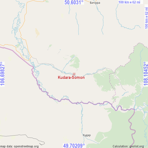
Kudara-Somon GPS coordinates[2]
50° 9' 16.992" North, 107° 24' 5.004" East
| Map corner | latitude | longitude |
|---|---|---|
| Upper-left | 50.6031°, | 106.69827° |
| Center: | 50.15472°, | 107.40139° |
| Lower-right: | 49.70209°, | 108.10452° |
| Map W x H: | 100.2×100.2 km | = 62.3×62.3mi |
| max Lat: | 73.50819° ⇑77.6% North |
| Kudara-Somon: | 50.15472° |
| min Lat: | ⇓22.4% South 41.28413° |
| min Long | Kudara-Somon | max Long |
| -179.12198° | 107.40139° | 179.35046° |
| W 90.4%⇐ | ⇒9.6% E |
Elevation
Elevation of Kudara-Somon is 747 m = 2451 ft, and this is 544.4 m = 1786 ft above average elevation for this country.
| Max E: |
2518 m = 8261 ft | 3.3% |
| Kudara-Somon | 747 m 2451 ft | |
| Avg. | 202.6 m = 665 ft | |
Min E: |
-28 m = -92 ft | 96.7% |
See also: Russia elevation on elevation.city.
Geographical zone
Kudara-Somon is located in North temperate zone (between Tropic of Cancer and the Arctic Circle). Distance of this North polar circle is 1824.5 km =1133.7 mi to North.| Distance of | km | miles | from Kudara-Somon |
|---|---|---|---|
| North Pole | 4430.4 | 2752.9 | to North |
| Arctic Circle | 1824.5 | 1133.7 | to North |
| Tropic Cancer | 2970.8 | 1846 | to South |
| Equator | 5576.7 | 3465.2 | to South |


Nearby cities:
15 places around Kudara-Somon: (largest is in red/bold)
• Bichura
50.2 km =31.2 mi,  16°
16°
• Chikoy
36.6 km =22.7 mi,  289°
289°
• Dzhida
104.2 km =64.7 mi,  303°
303°
• Gashey
98.4 km =61.1 mi,  358°
358°
• Khonkholoy
123.2 km =76.6 mi,  28°
28°
• Krasnyy Chikoy
98.9 km =61.5 mi,  76°
76°
• Kyakhta
71.3 km =44.3 mi, 288°
• Mukhorshibir’
104 km =64.6 mi, 16°
• Naushki
95.5 km =59.3 mi, 285°
• Nikol’sk
132 km =82 mi, 29°
• Novosretenka
65.9 km =40.9 mi, 17°
• Novyy Zagan
100.5 km =62.4 mi,  14°
14°
• Okino-Klyuchi
53 km =32.9 mi,  337°
337°
• Selenduma
117.6 km =73.1 mi,  315°
315°
• Sharalday
98.3 km =61.1 mi, 10°
Sources, notices
• [Note1] Compared only with cities in Russia existing in our database
• [Src1] Map data: © OpenStreetMap contributors (CC-BY-SA)
• [Src2] Other city data from geonames.org with taken over terms of usage.
• [Src3] Geographical zone / Annual Mean Temperature by Robert A. Rohde @ Wikipedia
