Koboldo geodata
Koboldo (Amur Oblast) is a populated place; located in Russia in Asia/Yakutsk (GMT+9) time zone. With population of 530 people, there are 4943 cities with bigger population in this country. Compared to other cities in Russia, 63.1% of cities are located further ↑North; 95.9% of cities are located further ←West and 92.7% of cities have lower elevation than Koboldo. Note1


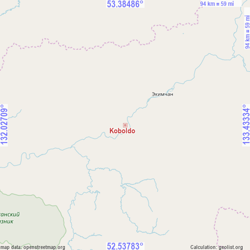
Koboldo GPS coordinates[2]
52° 57' 48.312" North, 132° 43' 48.756" East
| Map corner | latitude | longitude |
|---|---|---|
| Upper-left | 53.38486°, | 132.02709° |
| Center: | 52.96342°, | 132.73021° |
| Lower-right: | 52.53783°, | 133.43334° |
| Map W x H: | 94.2×94.2 km | = 58.5×58.5mi |
| max Lat: | 73.50819° ⇑63.1% North |
| Koboldo: | 52.96342° |
| min Lat: | ⇓36.9% South 41.28413° |
| min Long | Koboldo | max Long |
| -179.12198° | 132.73021° | 179.35046° |
| W 95.9%⇐ | ⇒4.1% E |
Elevation
Elevation of Koboldo is 525 m = 1722 ft, and this is 322.4 m = 1058 ft above average elevation for this country.
| Max E: |
2518 m = 8261 ft | 7.3% |
| Koboldo | 525 m 1722 ft | |
| Avg. | 202.6 m = 665 ft | |
Min E: |
-28 m = -92 ft | 92.7% |
See also: Russia elevation on elevation.city.
Geographical zone
Koboldo is located in North temperate zone (between Tropic of Cancer and the Arctic Circle). Distance of this North polar circle is 1512.2 km =939.6 mi to North.| Distance of | km | miles | from Koboldo |
|---|---|---|---|
| North Pole | 4118.1 | 2558.9 | to North |
| Arctic Circle | 1512.2 | 939.6 | to North |
| Tropic Cancer | 3283.1 | 2040 | to South |
| Equator | 5889 | 3659.3 | to South |


Nearby cities:
14 places around Koboldo: (largest is in red/bold)
• Berëzovyy
246 km =152.9 mi,  125°
125°
• Bira
440.9 km =274 mi,  182°
182°
• Chegdomyn
204.9 km =127.3 mi,  174°
174°
• Chumikan
258.6 km =160.7 mi,  40°
40°
• Ekimchan
18.4 km =11.4 mi,  49°
49°
• Imeni Poliny Osipenko
260.2 km =161.7 mi,  103°
103°
• Kul’dur
424.8 km =264 mi,  190°
190°
• Novyy Urgal
210.6 km =130.9 mi, 182°
• Sofiysk
116 km =72.1 mi, 132°
• Stoyba
70.9 km =44.1 mi,  254°
254°
• Talakan
344.9 km =214.3 mi,  209°
209°
• Tokur
21.9 km =13.6 mi,  29°
29°
• Tyrma
326.7 km =203 mi, 187°
• Zlatoustovsk
58.2 km =36.2 mi,  89°
89°
Sources, notices
• [Note1] Compared only with cities in Russia existing in our database
• [Src1] Map data: © OpenStreetMap contributors (CC-BY-SA)
• [Src2] Other city data from geonames.org with taken over terms of usage.
• [Src3] Geographical zone / Annual Mean Temperature by Robert A. Rohde @ Wikipedia
