Stoyba geodata
Stoyba (Amur Oblast) is a populated place; located in Russia in Asia/Yakutsk (GMT+9) time zone. With population of 895 people, there are 4705 cities with bigger population in this country. Compared to other cities in Russia, 64.1% of cities are located further ↑North; 94.8% of cities are located further ←West and 86.8% of cities have lower elevation than Stoyba. Note1


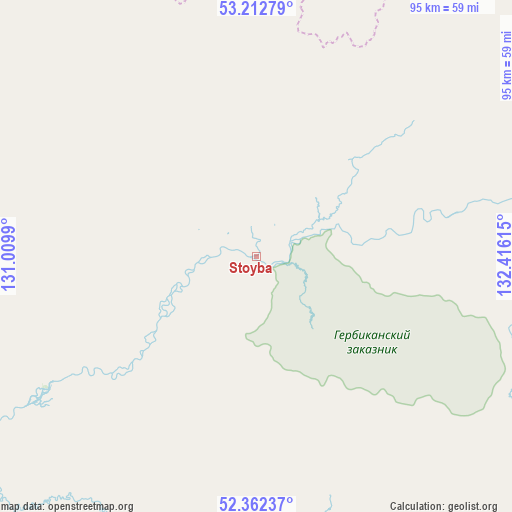
Stoyba GPS coordinates[2]
52° 47' 22.776" North, 131° 42' 46.872" East
| Map corner | latitude | longitude |
|---|---|---|
| Upper-left | 53.21279°, | 131.0099° |
| Center: | 52.78966°, | 131.71302° |
| Lower-right: | 52.36237°, | 132.41615° |
| Map W x H: | 94.6×94.6 km | = 58.8×58.8mi |
| max Lat: | 73.50819° ⇑64.1% North |
| Stoyba: | 52.78966° |
| min Lat: | ⇓35.9% South 41.28413° |
| min Long | Stoyba | max Long |
| -179.12198° | 131.71302° | 179.35046° |
| W 94.8%⇐ | ⇒5.2% E |
Elevation
Elevation of Stoyba is 367 m = 1204 ft, and this is 164.4 m = 539 ft above average elevation for this country.
| Max E: |
2518 m = 8261 ft | 13.2% |
| Stoyba | 367 m 1204 ft | |
| Avg. | 202.6 m = 665 ft | |
Min E: |
-28 m = -92 ft | 86.8% |
See also: Russia elevation on elevation.city.
Geographical zone
Stoyba is located in North temperate zone (between Tropic of Cancer and the Arctic Circle). Distance of this North polar circle is 1531.5 km =951.6 mi to North.| Distance of | km | miles | from Stoyba |
|---|---|---|---|
| North Pole | 4137.4 | 2570.9 | to North |
| Arctic Circle | 1531.5 | 951.6 | to North |
| Tropic Cancer | 3263.7 | 2028 | to South |
| Equator | 5869.7 | 3647.3 | to South |


Nearby cities:
15 places around Stoyba: (largest is in red/bold)
• Belogorsk
304.5 km =189.2 mi,  226°
226°
• Chegdomyn
204.9 km =127.3 mi,  154°
154°
• Ekimchan
87.9 km =54.6 mi,  69°
69°
• Koboldo
70.9 km =44.1 mi, 74°
• Novyy Urgal
200.6 km =124.6 mi,  162°
162°
• Romny
284.1 km =176.5 mi,  215°
215°
• Seryshevo
296 km =183.9 mi, 230°
• Sofiysk
165.3 km =102.7 mi,  111°
111°
• Svobodnyy
290.3 km =180.4 mi,  237°
237°
• Talakan
298.1 km =185.2 mi,  199°
199°
• Tokur
87.7 km =54.5 mi,  64°
64°
• Tsiolkovskiy
269.9 km =167.7 mi,  245°
245°
• Tyrma
306.4 km =190.4 mi,  174°
174°
• Yekaterinoslavka
323.3 km =200.9 mi,  213°
213°
• Zlatoustovsk
128.2 km =79.7 mi,  81°
81°
Sources, notices
• [Note1] Compared only with cities in Russia existing in our database
• [Src1] Map data: © OpenStreetMap contributors (CC-BY-SA)
• [Src2] Other city data from geonames.org with taken over terms of usage.
• [Src3] Geographical zone / Annual Mean Temperature by Robert A. Rohde @ Wikipedia
