Vydrino geodata
Vydrino (Buryatiya Republic) is a populated place; located in Russia in Asia/Irkutsk (GMT+8) time zone. With population of 5,300 people, there are 2512 cities with bigger population in this country. Compared to other cities in Russia, 72.8% of cities are located further ↑North; 89.7% of cities are located further ←West and 90.6% of cities have lower elevation than Vydrino. Note1


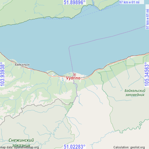
Vydrino GPS coordinates[2]
51° 27' 46.8" North, 104° 38' 33" East
| Map corner | latitude | longitude |
|---|---|---|
| Upper-left | 51.89896°, | 103.93938° |
| Center: | 51.463°, | 104.6425° |
| Lower-right: | 51.02283°, | 105.34563° |
| Map W x H: | 97.4×97.4 km | = 60.5×60.5mi |
| max Lat: | 73.50819° ⇑72.8% North |
| Vydrino: | 51.463° |
| min Lat: | ⇓27.2% South 41.28413° |
| min Long | Vydrino | max Long |
| -179.12198° | 104.6425° | 179.35046° |
| W 89.7%⇐ | ⇒10.3% E |
Elevation
Elevation of Vydrino is 469 m = 1539 ft, and this is 266.4 m = 874 ft above average elevation for this country.
| Max E: |
2518 m = 8261 ft | 9.4% |
| Vydrino | 469 m 1539 ft | |
| Avg. | 202.6 m = 665 ft | |
Min E: |
-28 m = -92 ft | 90.6% |
See also: Russia elevation on elevation.city.
Geographical zone
Vydrino is located in North temperate zone (between Tropic of Cancer and the Arctic Circle). Distance of this North polar circle is 1679 km =1043.3 mi to North.| Distance of | km | miles | from Vydrino |
|---|---|---|---|
| North Pole | 4284.9 | 2662.5 | to North |
| Arctic Circle | 1679 | 1043.3 | to North |
| Tropic Cancer | 3116.2 | 1936.3 | to South |
| Equator | 5722.1 | 3555.5 | to South |


Nearby cities:
15 places around Vydrino: (largest is in red/bold)
• Babushkin
88.9 km =55.2 mi,  71°
71°
• Baykal’sk
35.3 km =21.9 mi,  279°
279°
• Bol’shaya Rechka
54.9 km =34.1 mi,  6°
6°
• Bol’shoye Goloustnoye
82.9 km =51.5 mi,  39°
39°
• Kultuk
71.4 km =44.4 mi,  293°
293°
• Listvyanka
46.2 km =28.7 mi,  19°
19°
• Markova
88.1 km =54.7 mi,  340°
340°
• Moty
85.1 km =52.9 mi,  323°
323°
• Novolisikha
86.3 km =53.6 mi,  351°
351°
• Pad’ Mel’nichnaya
79.6 km =49.5 mi, 346°
• Rechka-Vydrino
14.2 km =8.8 mi,  78°
78°
• Shamanka
87.8 km =54.6 mi, 319°
• Slyudyanka
68.3 km =42.4 mi, 288°
• Tankhoy
35.1 km =21.8 mi, 72°
• Utulik
41.6 km =25.8 mi, 282°
Sources, notices
• [Note1] Compared only with cities in Russia existing in our database
• [Src1] Map data: © OpenStreetMap contributors (CC-BY-SA)
• [Src2] Other city data from geonames.org with taken over terms of usage.
• [Src3] Geographical zone / Annual Mean Temperature by Robert A. Rohde @ Wikipedia
