Babstovo geodata
Babstovo (Jewish Autonomous Oblast) is a populated place; located in Russia in Asia/Vladivostok (GMT+10) time zone. With population of 3,685 people, there are 3283 cities with bigger population in this country. Compared to other cities in Russia, 80.4% of cities are located further ↑North; 95.8% of cities are located further ←West and 73.8% of cities have higher elevation than Babstovo. Note1


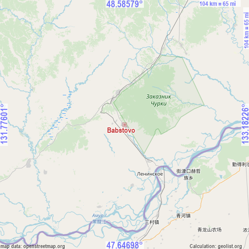
Babstovo GPS coordinates[2]
48° 7' 6.708" North, 132° 28' 44.868" East
| Map corner | latitude | longitude |
|---|---|---|
| Upper-left | 48.58579°, | 131.77601° |
| Center: | 48.11853°, | 132.47913° |
| Lower-right: | 47.64698°, | 133.18226° |
| Map W x H: | 104.4×104.4 km | = 64.9×64.9mi |
| max Lat: | 73.50819° ⇑80.4% North |
| Babstovo: | 48.11853° |
| min Lat: | ⇓19.6% South 41.28413° |
| min Long | Babstovo | max Long |
| -179.12198° | 132.47913° | 179.35046° |
| W 95.8%⇐ | ⇒4.2% E |
Elevation
Elevation of Babstovo is 92 m = 302 ft, and this is 110.6 m = 363 ft below average elevation for this country.
| Max E: |
2518 m = 8261 ft | 73.8% |
| Avg. | 202.6 m = 665 ft | |
| Babstovo | 92 m = 302 ft | |
Min E: |
-28 m = -92 ft | 26.2% |
See also: Russia elevation on elevation.city.
Geographical zone
Babstovo is located in North temperate zone (between Tropic of Cancer and the Arctic Circle). Distance of this North polar circle is 2050.9 km =1274.4 mi to North.| Distance of | km | miles | from Babstovo |
|---|---|---|---|
| North Pole | 4656.8 | 2893.6 | to North |
| Arctic Circle | 2050.9 | 1274.4 | to North |
| Tropic Cancer | 2744.4 | 1705.3 | to South |
| Equator | 5350.3 | 3324.5 | to South |


Nearby cities:
15 places around Babstovo: (largest is in red/bold)
• Amurzet
113.4 km =70.5 mi,  245°
245°
• Bira
98.2 km =61 mi,  359°
359°
• Birakan
112.1 km =69.7 mi,  330°
330°
• Birobidzhan
81.8 km =50.8 mi,  23°
23°
• Izvestkovyy
117.6 km =73.1 mi,  324°
324°
• Khingansk
146.7 km =91.2 mi, 319°
• Khor
185.3 km =115.1 mi,  97°
97°
• Kul’dur
135.6 km =84.3 mi, 332°
• Leninskoye
22.9 km =14.2 mi,  152°
152°
• Lermontovka
176 km =109.4 mi,  127°
127°
• Londoko
106.3 km =66.1 mi,  340°
340°
• Priamurskiy
184.9 km =114.9 mi,  75°
75°
• Smidovich
111.7 km =69.4 mi,  61°
61°
• Volochayevka Vtoraya
163.2 km =101.4 mi,  72°
72°
• Vyazemskiy
181.8 km =113 mi,  110°
110°
Sources, notices
• [Note1] Compared only with cities in Russia existing in our database
• [Src1] Map data: © OpenStreetMap contributors (CC-BY-SA)
• [Src2] Other city data from geonames.org with taken over terms of usage.
• [Src3] Geographical zone / Annual Mean Temperature by Robert A. Rohde @ Wikipedia
