Khingansk geodata
Khingansk (Jewish Autonomous Oblast) is a populated place; located in Russia in Asia/Vladivostok (GMT+10) time zone. With population of 2,093 people, there are 4117 cities with bigger population in this country. Compared to other cities in Russia, 78.8% of cities are located further ↑North; 94.6% of cities are located further ←West and 89.7% of cities have lower elevation than Khingansk. Note1


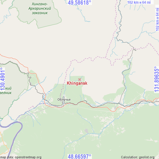
Khingansk GPS coordinates[2]
49° 7' 41.556" North, 131° 11' 35.592" East
| Map corner | latitude | longitude |
|---|---|---|
| Upper-left | 49.58618°, | 130.4901° |
| Center: | 49.12821°, | 131.19322° |
| Lower-right: | 48.66597°, | 131.89635° |
| Map W x H: | 102.3×102.3 km | = 63.6×63.6mi |
| max Lat: | 73.50819° ⇑78.8% North |
| Khingansk: | 49.12821° |
| min Lat: | ⇓21.2% South 41.28413° |
| min Long | Khingansk | max Long |
| -179.12198° | 131.19322° | 179.35046° |
| W 94.6%⇐ | ⇒5.4% E |
Elevation
Elevation of Khingansk is 445 m = 1460 ft, and this is 242.4 m = 795 ft above average elevation for this country.
| Max E: |
2518 m = 8261 ft | 10.3% |
| Khingansk | 445 m 1460 ft | |
| Avg. | 202.6 m = 665 ft | |
Min E: |
-28 m = -92 ft | 89.7% |
See also: Russia elevation on elevation.city.
Geographical zone
Khingansk is located in North temperate zone (between Tropic of Cancer and the Arctic Circle). Distance of this North polar circle is 1938.6 km =1204.6 mi to North.| Distance of | km | miles | from Khingansk |
|---|---|---|---|
| North Pole | 4544.5 | 2823.8 | to North |
| Arctic Circle | 1938.6 | 1204.6 | to North |
| Tropic Cancer | 2856.6 | 1775 | to South |
| Equator | 5462.5 | 3394.2 | to South |


Nearby cities:
15 places around Khingansk: (largest is in red/bold)
• Arkhara
86.8 km =53.9 mi,  292°
292°
• Babstovo
146.7 km =91.2 mi,  139°
139°
• Bira
94 km =58.4 mi,  98°
98°
• Birakan
41.2 km =25.6 mi,  111°
111°
• Birobidzhan
131.7 km =81.8 mi, 106°
• Bureya
125.4 km =77.9 mi,  307°
307°
• Izvestkovyy
30.9 km =19.2 mi,  122°
122°
• Kul’dur
33.5 km =20.8 mi,  75°
75°
• Londoko
59.4 km =36.9 mi, 101°
• Novobureyskiy
120.9 km =75.1 mi, 307°
• Novoraychikhinsk
136.9 km =85.1 mi,  302°
302°
• Raychikhinsk
148.4 km =92.2 mi, 299°
• Shirokiy
139.8 km =86.9 mi, 300°
• Talakan
142.7 km =88.7 mi,  332°
332°
• Tyrma
123.3 km =76.6 mi,  34°
34°
Sources, notices
• [Note1] Compared only with cities in Russia existing in our database
• [Src1] Map data: © OpenStreetMap contributors (CC-BY-SA)
• [Src2] Other city data from geonames.org with taken over terms of usage.
• [Src3] Geographical zone / Annual Mean Temperature by Robert A. Rohde @ Wikipedia
