Malaya Pitsa geodata
Malaya Pitsa (Nizhny Novgorod Oblast) is a populated place; located in Russia in Europe/Moscow (GMT+3) time zone. With population of 524 people, there are 4950 cities with bigger population in this country. Compared to other cities in Russia, 63% of cities are located further ↓South; 52.3% of cities are located further →East and 51.1% of cities have higher elevation than Malaya Pitsa. Note1


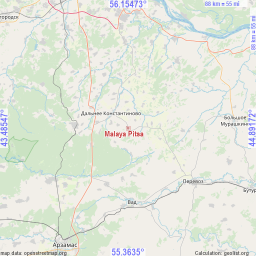
Malaya Pitsa GPS coordinates[2]
55° 45' 40.032" North, 44° 11' 18.924" East
| Map corner | latitude | longitude |
|---|---|---|
| Upper-left | 56.15473°, | 43.48547° |
| Center: | 55.76112°, | 44.18859° |
| Lower-right: | 55.3635°, | 44.89172° |
| Map W x H: | 88×88 km | = 54.7×54.7mi |
| max Lat: | 73.50819° ⇑37% North |
| Malaya Pitsa: | 55.76112° |
| min Lat: | ⇓63% South 41.28413° |
| min Long | Malaya Pitsa | max Long |
| -179.12198° | 44.18859° | 179.35046° |
| W 47.7%⇐ | ⇒52.3% E |
Elevation
Elevation of Malaya Pitsa is 142 m = 466 ft, and this is 60.6 m = 199 ft below average elevation for this country.
| Max E: |
2518 m = 8261 ft | 51.1% |
| Avg. | 202.6 m = 665 ft | |
| Malaya Pitsa | 142 m = 466 ft | |
Min E: |
-28 m = -92 ft | 48.9% |
See also: Russia elevation on elevation.city.
Geographical zone
Malaya Pitsa is located in North temperate zone (between Tropic of Cancer and the Arctic Circle). Distance of this North polar circle is 1201.1 km =746.3 mi to North.| Distance of | km | miles | from Malaya Pitsa |
|---|---|---|---|
| North Pole | 3807 | 2365.6 | to North |
| Arctic Circle | 1201.1 | 746.3 | to North |
| Tropic Cancer | 3594.1 | 2233.3 | to South |
| Equator | 6200.1 | 3852.6 | to South |


Nearby cities:
15 places around Malaya Pitsa: (largest is in red/bold)
• Arzamas
46.2 km =28.7 mi,  208°
208°
• Bol’shoye Murashkino
36.8 km =22.9 mi,  86°
86°
• Burevestnik
49.3 km =30.6 mi,  329°
329°
• Buturlino
49.4 km =30.7 mi,  115°
115°
• Chernukha
32.7 km =20.3 mi,  236°
236°
• Dal’neye Konstantinovo
8 km =5 mi,  313°
313°
• Imeni M. I. Kalinina
47.3 km =29.4 mi,  10°
10°
• Kstovo
42.9 km =26.7 mi,  0°
0°
• Pamyat’ Parizhskoy Kommuny
42.7 km =26.5 mi,  26°
26°
• Perevoz
28.9 km =18 mi,  129°
129°
• Rabotki
40.5 km =25.2 mi,  39°
39°
• Surovatikha
18.2 km =11.3 mi,  271°
271°
• Vad
25.7 km =16 mi,  176°
176°
• Vyyezdnoye
49.2 km =30.6 mi, 210°
• Zelyony Gorod
46.9 km =29.1 mi,  351°
351°
Sources, notices
• [Note1] Compared only with cities in Russia existing in our database
• [Src1] Map data: © OpenStreetMap contributors (CC-BY-SA)
• [Src2] Other city data from geonames.org with taken over terms of usage.
• [Src3] Geographical zone / Annual Mean Temperature by Robert A. Rohde @ Wikipedia
