Tuymazy geodata
Tuymazy (Bashkortostan Republic) is a populated place; located in Russia in Asia/Yekaterinburg (GMT+5) time zone. With population of 68,829 people, there are 293 cities with bigger population in this country. Compared to other cities in Russia, 50.3% of cities are located further ↑North; 65.4% of cities are located further ←West and 65.3% of cities have higher elevation than Tuymazy. Note1


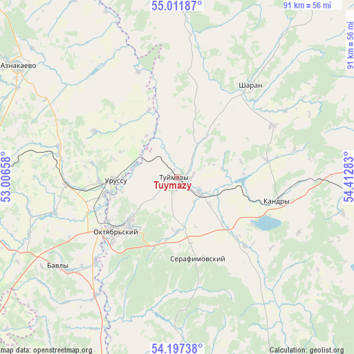
Tuymazy GPS coordinates[2]
54° 36' 23.976" North, 53° 42' 34.92" East
| Map corner | latitude | longitude |
|---|---|---|
| Upper-left | 55.01187°, | 53.00658° |
| Center: | 54.60666°, | 53.7097° |
| Lower-right: | 54.19738°, | 54.41283° |
| Map W x H: | 90.6×90.6 km | = 56.3×56.3mi |
| max Lat: | 73.50819° ⇑50.3% North |
| Tuymazy: | 54.60666° |
| min Lat: | ⇓49.7% South 41.28413° |
| min Long | Tuymazy | max Long |
| -179.12198° | 53.7097° | 179.35046° |
| W 65.4%⇐ | ⇒34.6% E |
Elevation
Elevation of Tuymazy is 113 m = 371 ft, and this is 89.6 m = 294 ft below average elevation for this country.
| Max E: |
2518 m = 8261 ft | 65.3% |
| Avg. | 202.6 m = 665 ft | |
| Tuymazy | 113 m = 371 ft | |
Min E: |
-28 m = -92 ft | 34.7% |
See also: Tuymazy elevation on elevation.city.
Geographical zone
Tuymazy is located in North temperate zone (between Tropic of Cancer and the Arctic Circle). Distance of this North polar circle is 1329.5 km =826.1 mi to North.| Distance of | km | miles | from Tuymazy |
|---|---|---|---|
| North Pole | 3935.4 | 2445.3 | to North |
| Arctic Circle | 1329.5 | 826.1 | to North |
| Tropic Cancer | 3465.8 | 2153.5 | to South |
| Equator | 6071.7 | 3772.8 | to South |


Nearby cities:
15 places around Tuymazy: (largest is in red/bold)
• Aksakovo
69.9 km =43.4 mi,  155°
155°
• Aktyubinskiy
62.5 km =38.8 mi,  291°
291°
• Bakaly
63.9 km =39.7 mi,  5°
5°
• Bavly
37.5 km =23.3 mi,  230°
230°
• Belebey
60.5 km =37.6 mi,  154°
154°
• Bugul’ma
59.2 km =36.8 mi,  262°
262°
• Buzdyak
54.2 km =33.7 mi,  92°
92°
• Kandry
26.6 km =16.5 mi,  99°
99°
• Nizhnetroitskiy
29.9 km =18.6 mi,  183°
183°
• Oktyabr’skiy
20.8 km =12.9 mi, 227°
• Serafimovskiy
21.1 km =13.1 mi, 164°
• Sharan
29.9 km =18.6 mi,  38°
38°
• Subkhankulovo
8.5 km =5.3 mi,  129°
129°
• Urussu
15.9 km =9.9 mi,  266°
266°
• Yermekeyevo
59 km =36.7 mi, 182°
Sources, notices
• [Note1] Compared only with cities in Russia existing in our database
• [Src1] Map data: © OpenStreetMap contributors (CC-BY-SA)
• [Src2] Other city data from geonames.org with taken over terms of usage.
• [Src3] Geographical zone / Annual Mean Temperature by Robert A. Rohde @ Wikipedia
