Vozhega geodata
Vozhega (Vologda) is a populated place; located in Russia in Europe/Moscow (GMT+3) time zone. With population of 6,703 people, there are 2075 cities with bigger population in this country. Compared to other cities in Russia, 92.1% of cities are located further ↓South; 66.4% of cities are located further →East and 54.9% of cities have lower elevation than Vozhega. Note1


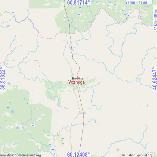
Vozhega GPS coordinates[2]
60° 28' 20.856" North, 40° 13' 16.824" East
| Map corner | latitude | longitude |
|---|---|---|
| Upper-left | 60.81714°, | 39.51822° |
| Center: | 60.47246°, | 40.22134° |
| Lower-right: | 60.12408°, | 40.92447° |
| Map W x H: | 77.1×77.1 km | = 47.9×47.9mi |
| max Lat: | 73.50819° ⇑7.9% North |
| Vozhega: | 60.47246° |
| min Lat: | ⇓92.1% South 41.28413° |
| min Long | Vozhega | max Long |
| -179.12198° | 40.22134° | 179.35046° |
| W 33.6%⇐ | ⇒66.4% E |
Elevation
Elevation of Vozhega is 156 m = 512 ft, and this is 46.6 m = 153 ft below average elevation for this country.
| Max E: |
2518 m = 8261 ft | 45.1% |
| Avg. | 202.6 m = 665 ft | |
| Vozhega | 156 m = 512 ft | |
Min E: |
-28 m = -92 ft | 54.9% |
See also: Russia elevation on elevation.city.
Geographical zone
Vozhega is located in North temperate zone (between Tropic of Cancer and the Arctic Circle). Distance of this North polar circle is 677.3 km =420.9 mi to North.| Distance of | km | miles | from Vozhega |
|---|---|---|---|
| North Pole | 3283.2 | 2040.1 | to North |
| Arctic Circle | 677.3 | 420.9 | to North |
| Tropic Cancer | 4118 | 2558.8 | to South |
| Equator | 6723.9 | 4178 | to South |


Nearby cities:
15 places around Vozhega: (largest is in red/bold)
• Ferapontovo
108 km =67.1 mi,  237°
237°
• Kadnikov
108.1 km =67.2 mi,  176°
176°
• Kharovsk
56.5 km =35.1 mi, 181°
• Kirillov
122.3 km =76 mi, 236°
• Konosha
55.8 km =34.7 mi,  1°
1°
• Podyuga
77.5 km =48.2 mi,  26°
26°
• Sokol
112.5 km =69.9 mi, 182°
• Solginskiy
88.5 km =55 mi,  43°
43°
• Syamzha
68.8 km =42.8 mi,  137°
137°
• Ust’-Shonosha
97.1 km =60.3 mi, 38°
• Ust’ye
97.4 km =60.5 mi,  196°
196°
• Vel’sk
121.6 km =75.6 mi,  56°
56°
• Verkhovazh’ye
104.2 km =64.7 mi,  72°
72°
• Voloshka
95.8 km =59.5 mi,  355°
355°
• Yertsevo
36.8 km =22.9 mi,  348°
348°
Sources, notices
• [Note1] Compared only with cities in Russia existing in our database
• [Src1] Map data: © OpenStreetMap contributors (CC-BY-SA)
• [Src2] Other city data from geonames.org with taken over terms of usage.
• [Src3] Geographical zone / Annual Mean Temperature by Robert A. Rohde @ Wikipedia
