Podyuga geodata
Podyuga (Arkhangelskaya) is a populated place; located in Russia in Europe/Moscow (GMT+3) time zone. With population of 2,977 people, there are 3790 cities with bigger population in this country. Compared to other cities in Russia, 93.1% of cities are located further ↓South; 63.6% of cities are located further →East and 52.1% of cities have higher elevation than Podyuga. Note1


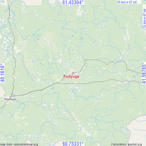
Podyuga GPS coordinates[2]
61° 5' 42" North, 40° 51' 52.992" East
| Map corner | latitude | longitude |
|---|---|---|
| Upper-left | 61.43304°, | 40.1616° |
| Center: | 61.095°, | 40.86472° |
| Lower-right: | 60.75331°, | 41.56785° |
| Map W x H: | 75.6×75.6 km | = 47×47mi |
| max Lat: | 73.50819° ⇑6.9% North |
| Podyuga: | 61.095° |
| min Lat: | ⇓93.1% South 41.28413° |
| min Long | Podyuga | max Long |
| -179.12198° | 40.86472° | 179.35046° |
| W 36.4%⇐ | ⇒63.6% E |
Elevation
Elevation of Podyuga is 140 m = 459 ft, and this is 62.6 m = 205 ft below average elevation for this country.
| Max E: |
2518 m = 8261 ft | 52.1% |
| Avg. | 202.6 m = 665 ft | |
| Podyuga | 140 m = 459 ft | |
Min E: |
-28 m = -92 ft | 47.9% |
See also: Russia elevation on elevation.city.
Geographical zone
Podyuga is located in North temperate zone (between Tropic of Cancer and the Arctic Circle). Distance of this North polar circle is 608 km =377.8 mi to North.| Distance of | km | miles | from Podyuga |
|---|---|---|---|
| North Pole | 3213.9 | 1997 | to North |
| Arctic Circle | 608 | 377.8 | to North |
| Tropic Cancer | 4187.2 | 2601.8 | to South |
| Equator | 6793.1 | 4221 | to South |


Nearby cities:
15 places around Podyuga: (largest is in red/bold)
• Arkhangelo-Shelokhovskaya
130.8 km =81.3 mi,  314°
314°
• Kargopol’
111.9 km =69.5 mi,  293°
293°
• Konosha
35.4 km =22 mi,  247°
247°
• Kuloy
87.9 km =54.6 mi,  94°
94°
• Nyandoma
72.6 km =45.1 mi,  330°
330°
• Shalakusha
129.7 km =80.6 mi,  345°
345°
• Shelokhovskaya
130.2 km =80.9 mi, 314°
• Solginskiy
26.2 km =16.3 mi,  101°
101°
• Syamzha
120.5 km =74.9 mi,  174°
174°
• Ust’-Shonosha
26.5 km =16.5 mi,  75°
75°
• Vel’sk
66.4 km =41.3 mi, 92°
• Verkhovazh’ye
74.7 km =46.4 mi,  121°
121°
• Voloshka
49.3 km =30.6 mi,  302°
302°
• Vozhega
77.5 km =48.2 mi,  206°
206°
• Yertsevo
53.6 km =33.3 mi,  231°
231°
Sources, notices
• [Note1] Compared only with cities in Russia existing in our database
• [Src1] Map data: © OpenStreetMap contributors (CC-BY-SA)
• [Src2] Other city data from geonames.org with taken over terms of usage.
• [Src3] Geographical zone / Annual Mean Temperature by Robert A. Rohde @ Wikipedia
